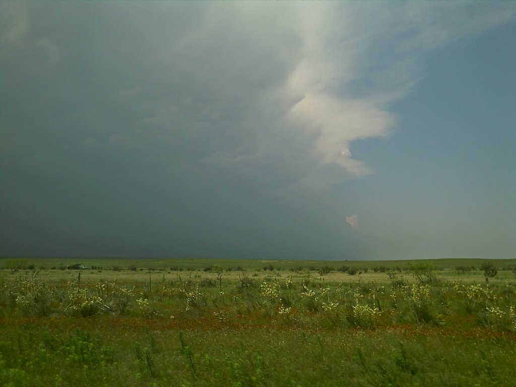
 We took the Wicked Witch 2 out to southern Colorado to fly the plane in storm conditions and hopefully get some cool video. However, strong outflow winds detached the rear prop and caused the plane to spin out of control before nosediving into the ground. The plane suffered minimal damage. In the event of the actual flight into a tornado, the plane is expected to be carried by the inflow winds rather than fighting against outflow. Video:
KRDO ColoSprgs Storm Chasers!
KAKE Wichita Storm Chase Team!

Denver's Channel 7 Storm Chasers


Wednesday, June 27, 2007
Wicked Witch 2 test flight #2 video
We took the Wicked Witch 2 out to southern Colorado to fly the plane in storm conditions and hopefully get some cool video. However, strong outflow winds detached the rear prop and caused the plane to spin out of control before nosediving into the ground. The plane suffered minimal damage. In the event of the actual flight into a tornado, the plane is expected to be carried by the inflow winds rather than fighting against outflow. Video:Wicked Witch 2 stalls and crashes
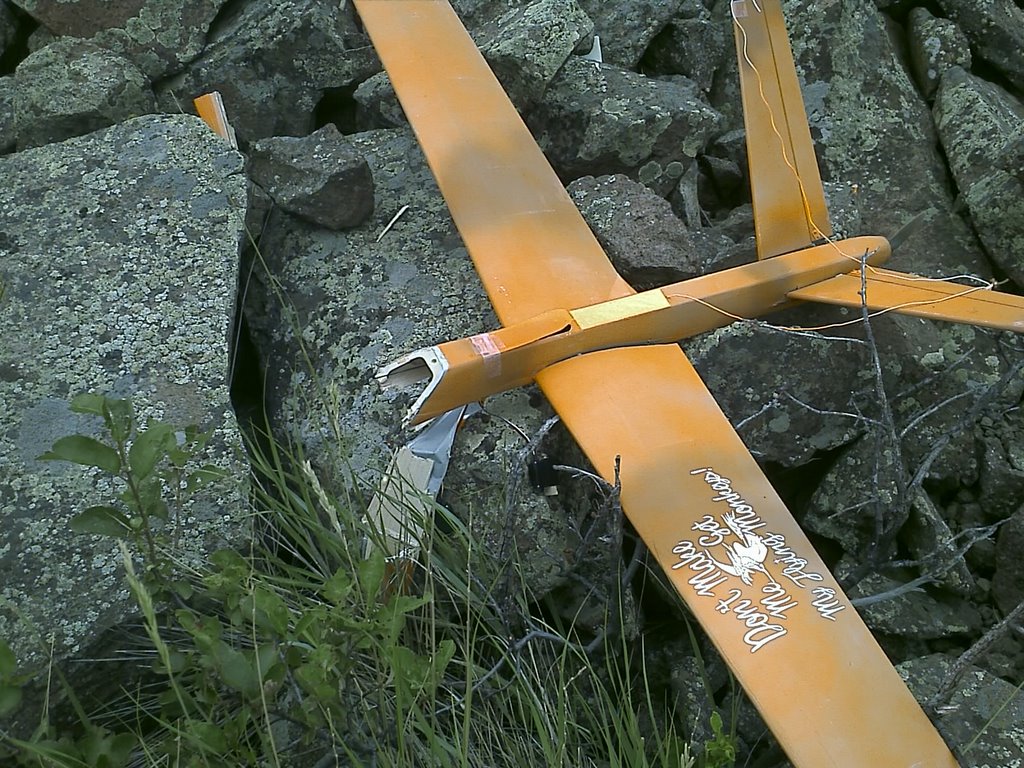
As I was coming in for a landing on the top of north table mountain in Golden, CO the WW2 stalled and crashed on rocks about 30 feet down the side of the cliff. I had to climb down to this spot to retrieve her, the good news is the camera survived so I should have some good video to post soon!
Edit: the impact of the crash popped the memory card loose out of the back of the camera so the video file was not saved! Unfortunately I have no record of this flight, it would have been really cool. I flew out and back many times over two cliff faces!
The good news is that I have two new fuselage kits coming this week so the WW2 will be flying again soon!
Tuesday, June 26, 2007
Tornado warned cell east of Pueblo

Mileage: 292
Slight risk for severe today

Saturday, June 23, 2007
Wicked Witch 2 - test flight 1 - wow!
![]()

Just Kidding! This is a dramatization of a possible launch into a tornado. Eric created this overlay and it shows what would be the ultimate intercept for this project! Read below and follow our progress as we develop an RC aircraft with the goal of flying near and in a tornado!!
This page is dedicated to the Wicked Witch RC Video Aircraft Project. The aircraft is a model airplane used to fly in and around Tornadoes/Thunderstorms and other interesting objects. It has the following specs:
Aircraft: Predator-B V-Tail, Handlaunch, Short Field Recovery, Backpack Portable
Wingspan: 73" two piece
Wing area: 369.6 sq in
Weight w/o camera: 24.7 oz
Control System: 3 Channel Futaba Radio, throttle and flapperon control
Motor: 400 brushless electric.
Power: 1100mW Lithium Polymer battery.
Prop: 6" pusher-style to keep forward view clear.
Camera: Hardened/Rubberized 640x480 pixels, 30fps, 1 hour record time, AVI format, USB Interface.
Recovery System: Onboard parachute and 600 foot range RFID locator to locate the camera if downed. Audible beep locator when transmitter is off.
Complete cost: ~$600.00
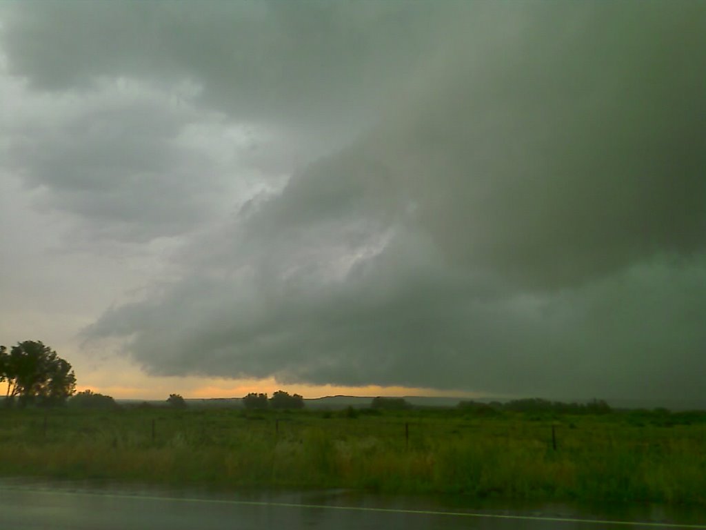
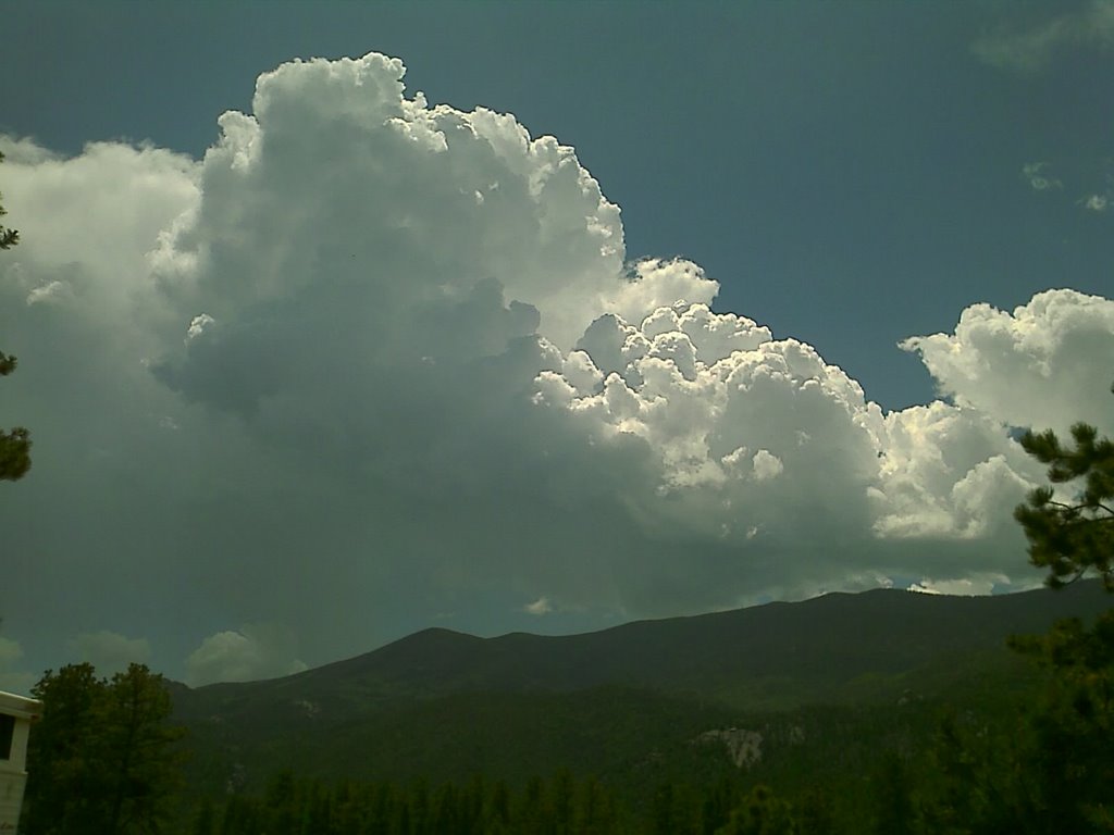
Eric nicely captures the Wicked Witch 2's flight near a severe thunderstorm updraft at Cope, CO!
 Highway 36 east of Cope, CO as seen from the Wicked Witch 2 camera at about 400 feet up!
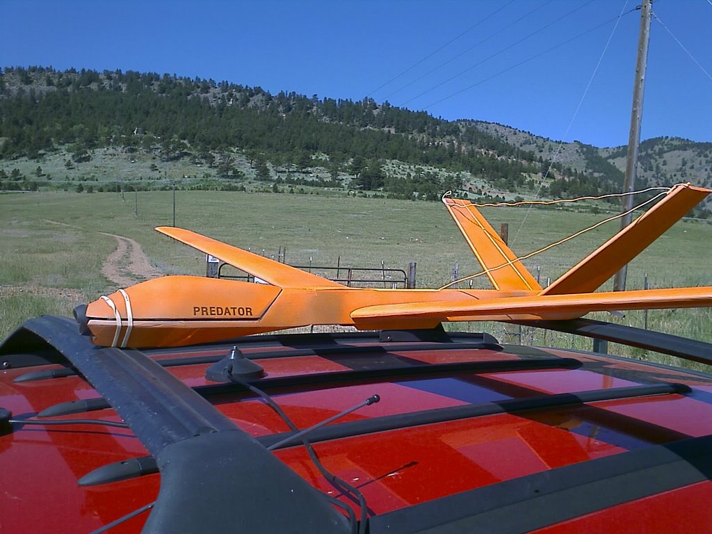
 Eric and I and the Subaru flying the WW2!
 The severe warned thunderstorm Rain Free Base as filmed from the WW2 at an altitude of approximately 300 feet. The WW2 was flying in the inflow winds of about 10-20kts and had a definate tendancy to want to go downwind quickly. I spent most of the flight fighting the flow as I didn't want to chase the plane out in the field. Had there been a tornado under this updraft it would have been the plane's natural tendancy to drift with the current and go straight into the updraft.
I have a locator coming from http://www.loc8torus.com that I will use to locate the video after it comes down hopefully within 600 feet of a road. That is the range of this device and it is definately needed as the plane is easily lost in tall grass and crops!
 Here's the NCAR building as seen from a screen grab from the WW2 video.
 View of the flatirons looking north from the NCAR mesa.

We took the Wicked Witch 2 out to southern Colorado to fly the plane in storm conditions and hopefully get some cool video. However, strong outflow winds detached the rear prop and caused the plane to spin out of control before nosediving into the ground. The plane suffered minimal damage. In the event of the actual flight into a tornado, the plane is expected to be carried by the inflow winds rather than fighting against outflow. Video:Watch Eric's video of the WW2 loosing it's prop and subsequent crash.
The Wicked Witch 2 makes it's first flight ever at Coal Creek Canyon!
Edit: I just posted the video above. It's awesome! I love the clarity of no propeller in the field of view and the resolution is great for such a small lightweight camera.
Watch the Wicked Witch 2 overfly the historic Union Pacific Steam Locomotive 844.

UP 844 speeds under the WW2 along HW85 on it's way the Cheyenne Frontier Days

Steam Locomotive 844 quickly heads up the tracks at 65mph!
Tuesday, June 19, 2007
Space Shuttle and International Space Station Overhead
 Tonight Colorado was offered a rare site. The Space Shuttle and the International Space Station passed overhead just after the shuttle separated and followed behind. The two points of light traversed the sky slowly over about 4 minutes as seen from the top of the road above my house at 9000'. Quite a site!
Tornado watch in w KS
Mileage: 270
Monday, June 18, 2007
Summertime pattern setting in
Tuesday, June 12, 2007
Tornado watch into e CO

Mileage: 528
Monday, June 11, 2007
Wicked Witch Test Flight 3
Today I drove the Wicked Witch out east of Frederick, CO where I found a short section of road for a test flight. Objectives for this flight where:
1) Test the video quality using a mini-DVR instead of the transmitter system.
2) Further test takeoff/landing in storm winds.
The takeoff was a little short and I almost stalled the plane. On further takeoffs I need to allow the plane to build up more speed before takeoff.
On takeoff you can see how the prob causes interference lines on the top of the video. A minute or so into the flight I rotate the camera to the right using the camera control servo and you can see the video clear up as the prop is moved out of the field of view. The Wicked Witch 2 will have a pusher prop so will not have prop interference problems.
I tried a loop, a roll and another loop. On the first loop the camera pointed into the sun which caused the video to wash out. By the second loop the video was beginning to recover when loop number two washed it out again. Keeping the video from pointing directly at the sun is something I'll have to avoid in the future.
The landing was a little rough as the thunderstorm was gusting out and causing dry microbursts in the area. I had to land across the road and ended up tail high in the weeds on the side of the road. The only damage was a rip the the horizontal stabilizer.
Saturday, June 09, 2007
Introducing the Wicked Witch 2!
 Borrowing from what I have learned from test flying the Wicked Witch, I have order the RC aircraft above. This will become the Wicked Witch 2. It is based off the Predator spy plane and has some advantages/disadvantages over the Wicked Witch 1.
Advantages:
1) It is electric powered making it quicker to launch and no messy fuel to gum up the video lens.
2) It is a pusher-prop design leaving the forward area free of prop interference.
3) It can possibly be hand launched in a stiff wind (not a problem near thunderstorm inflow).
Disadvatages:
1) It has a lower payload carrying capability meaning that I will have to lighten it up such as removing the landing gear and going with landing skids.
This model can be purchased here:
http://www.nitroplanes.com/uav3arfbrelr.html
Friday, June 08, 2007
2007-06-06 Report


On Weds we got the long lived tornado in the Badlands of South Dakota although a little far away as it dissipated as we got to the updraft and no further tornadoes appeared. We had no chances to deploy probes that day. Michael got some great shots of the first tornado.
We had a semi-truck blow over into the median of I-90 from a strong gustnado near the town of Murdo, SD
We shot south to the developing line in NE and caught lightning shots off this tail-end charlie storm near Broken Bow, NE.
Mileage: 1102
Motel Stays: 1
Wednesday, June 06, 2007
Weds June 6th looking nice!
 Michael, Eric and I are at the Comfort Inn in Valentine, NE right smack in the northern side of a 15% hatched area for tornadoes tomorrow. Was a little surprised to see the tornado risk area so far south into NE but will take it as all we have to do tomorrow is sleep in and evaluate tomorrows RUC and surface observations and then adjust slightly for tomorrow's chase. Looks like a good one for tornadoes!
Tuesday, June 05, 2007
On our way to Valentine, NE

Monday, June 04, 2007
Weds shaping up to be a big day!

Tuesday is our travel evening out to NE/SD for weds. Along the way we will be watching for potential action right in our backyard with SPC calling for tornadoes in e CO!
THIS WILL ENHANCE LOW LEVEL THERMAL/MOISTURE ADVECTION ACROSS THE REGION AS WELL AS DEEP LAYER SHEAR AHEAD OF THE DENVER CYCLONE. MUCAPE INCREASES TO BETWEEN 2000-2200 J/KG OVER ERN CO BY LATE TUESDAY AFTERNOON WITH STEEP MID LEVEL LAPSE RATES OF AROUND 8.5C/KM. THIS SCENARIO LOOKS TO SPELL FAVORABLE CONDITIONS FOR ISOLATED SEVERE STORMS DEVELOPING OVER ERN CO TUESDAY AFTERNOON FORMING INTO MCS ACTIVITY TUESDAY NIGHT THAT WILL MOVE EWD/SEWD INTO THE HIGH PLAINS REGION OF WRN KS SWD INTO THE TX PANHANDLE. MODEL HODOGRAPHS ACROSS ERN CO INDICATES FAVORABLE PROFILES WITH 0-6KM SHEAR AROUND 45 KT AND 0-3KM HELICITY BETWEEN 200-250 M2/S2 SUFFICIENT TO SUPPORT ROTATING UPDRAFTS INITIALLY. THIS WILL SUPPORT POSSIBLY SOME ISOLATED TORNADOES OVER ERN CO...BUT MORE LIKELY LARGE HAIL AS THE STORMS DEVELOP/INTENSIFY ACROSS THE REGION INTO THE TX PANHANDLE.
From the Denver AFD: .LONG TERM...WINDS INCREASE TUESDAY NIGHT...PEAKING WEDNESDAY AHEAD OF THE TROUGH AXIS. THE INCREASING WINDS WILL LEAD TO A SIGNIFICANT THREAT OF SEVERE STORMS TUESDAY EVENING AS THE WIND PROFILE BECOMESVERY FAVORABLE FOR SUPERCELLS. LOW LEVEL JET INCREASES IN THE EVENING WITH NAM SOUNDING AT AKRON SHOWING SOUTH WINDS AT 35 KT AT800 MB...GIVING 0-3 KM HELICITY OF 360 M2/S2. SO...SIGNIFICANT TORNADO POTENTIAL IF THE SITUATION SETS UP AS THE NAM SHOWS. THERE COULD BE A FOCUS IN CONVERGENCE BETWEEN SOUTH WINDS TO THE SOUTHEAST OF US AND MORE EASTERLY WINDS ACROSS NEBRASKA...ACROSS NORTHEAST OR EAST CENTRAL COLORADO. SINCE THE WINDS WILL BE INCREASING THROUGHTHE WHOLE ATMOSPHERE...WHATEVER DEVELOPS SHOULD PROPAGATE EASTWARDAND WILL LIKELY BE OUT OF OUR AREA BY MIDNIGHT.


 Precip breaks out on the NE/SD border at 0z west of Valentine, NE
 Nice strong 500mb southwesterly flow punching into NE.
 Capes over 4000 J/kg in the target area at 0z! Weds looks absolutely amazing with SPC already going moderate and 45% hatched for severe weather in e SD and NE.
WITH 60 TO 80 KT SWLY MID-LEVEL FLOW FORECAST TO SPREAD NEWD ACROSS THE PLAINS DURING THE AFTERNOON/EVENING ABOVE STRONG/INTENSIFYING SLY LOW-LEVEL FLOW...SHEAR SHOULD BE EXCEPTIONALLY-FAVORABLE -- GIVEN DEGREE OF AVAILABLE INSTABILITY -- FOR LARGE/INTENSE SUPERCELL STORMS. ALONG WITH THE POTENTIAL FOR VERY LARGE HAIL AND WIDESPREAD DAMAGING WINDS...TORNADOES ARE ALSO ANTICIPATED -- WITH A FEW SIGNIFICANT/LONG-TRACK TORNADOES POSSIBLE. GREATEST THREAT APPEARS TO EXIST ATTM ACROSS THE ERN HALVES OF SD AND NEB AND INTO SWRN MN/WRN IA.
Friday, June 01, 2007
Severe warned cell Oldham co TX
Mileage: 824
Motel Stays: 1
05/31/07 - Chase Report


 Chased mainly around the OK, Panhandle and saw two tornadoes and got some sweet structure shots! I chased with Tony L, my Dad, Silver Lining Tours, and DreamVisions.
Michael C.
Mileage: 216
Motel stays: 1
Subscribe to:
Posts (Atom)
The Carlsons', Verne, Michael and Eric

Contact Me for Helicopter Shots!
