

Woke up to a nice dusting of snow, and still coming down hard!
Live Geo-referenced Storm Chaser Video. First in the Field Aerial Live Streaming and Aerial Storm Intercepts. High Resolution Level II Radar Data. Severe Weather Forecasts and Reports by Storm Chasers/Severe Weather Videographers Verne, Michael and Eric Carlson. For live stream and video licensing contact us at: vernecarlson@hotmail.com

 It's been almost six months since May 4th when at 9:55pm CDT an EF5 tornado destroyed 95% of the structures in Greensburg, KS.
 In this picture we see Bay, Grove and Walnut Streets south of HW54. As you can see many of the blocks are empty with only the house pads remaining.
 Spruce Bay and Grove Streets on the west side of Greensburg.
 In the upper right a house still has tarps on the roof with large sections missing. The red car on the lower left is Michael, Eric and I from our launch point of the WW5 Digital Camera Plane.
  Here debris piles are on the street and house pads and foundation holes are all that remain. A new driveway has been added at the bottom of the picture.
 Along HW54 through the center of town a new Qwik Shop has been built (lower right). Next to it on both sides are damaged buildings including the old Grocery Store. The John Deere dealership has been rebuilt and opened. There is also a motel and welding shop. The Fire and Police department can be seen along the newly paved HW54 in temporary buildings at the upper left.
 An old foundation is dug out but is currently flooded by recent rains on the left. A new foundation is in the center.
 Modular home half sections await their foundation for placement in the upper left. At the bottom is the old driveway of a scraped house.
 New foundations and another modular home being completed. Other lots sit empty. HW54 is on the right.
 Another view of the new foundations and modular homes.
 Again same view of the new foundations and modular homes.
 View of the north side of Greensburg along with Kiowa county state park lake. Many scraped lots remain. Huge cottonwood trees are no taller than 15 feet high and are growing new branches and leaves out of the sides of the trunks.
 In this view we see how rebuilding has allowed the brown roofed house in the center to be placed at an angle on it's lot.
These photos were taken with the Wicked Witch 5 electric powered glider carrying a Nikon 5.1MP Camera. The glider was hand launched from the center of town and flown to an altitude of about 800 feet. This was a test of the system I plan to use in the following springs to document tornado paths and damage on the morning of big events.
Mileage: 1416
Motel Stays: 2


 This is nuts! The WRF shows the individual supercells along the dryline in central OK. I don't think I've ever seen that!


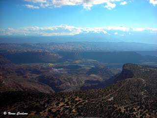
 Our camp at Dead Horse Point, UT


