Live Geo-referenced Storm Chaser Video. First in the Field Aerial Live Streaming and Aerial Storm Intercepts. High Resolution Level II Radar Data. Severe Weather Forecasts and Reports by Storm Chasers/Severe Weather Videographers Verne, Michael and Eric Carlson. For live stream and video licensing contact us at: vernecarlson@hotmail.com

KRDO ColoSprgs Storm Chasers!

KRDO

KAKE Wichita Storm Chase Team!

KAKE

Denver's Channel 7 Storm Chasers

KMGH 7 News

License this Live Stream Now!

Follow us LIVE on iMap Tracker! When you see a car we are live.


Thursday, March 29, 2007

2007-03-28 Report


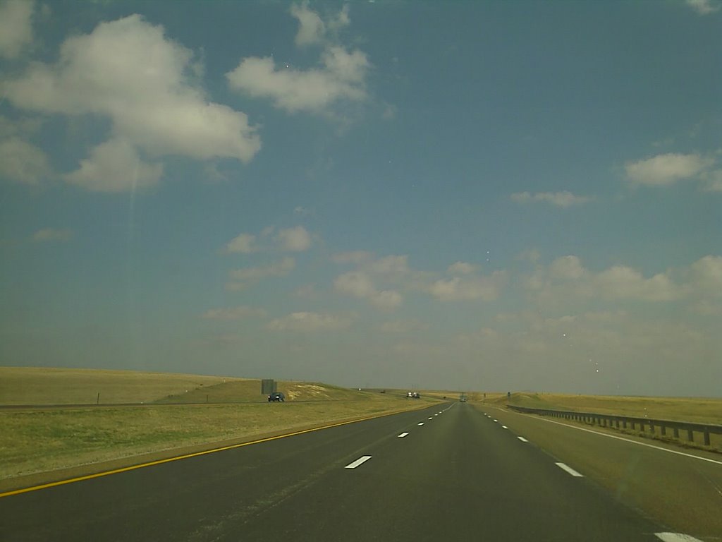
Eric and I watch the CU field in the OK panhandle east of the town of Balko, OK on HW 270.


We moved a little east on HW 270 to position ourselves to the east of the line of developing mesos coming out of the eastern TX panhandles. This view is looking back west at the multi-cell cluster that will soon become our meso of the day.


Tornado #1 touches down east of Booker, TX. It moves quickly north accross the road as we look out to the east.


Tornado #1 turns into a well defined cone as it moves north. We start to lose site of it in the RFD rains and move north towards Elmwood, OK.


Tornado #2 spins up south of Tornado #3, for a minute we have two tornadoes on the ground simultaneously!


Tornado #3 grows into a strong elephant trunk moving north, at this point it's close to crossing into OK.


Tornado #3 continues to grow, we move north through Elmwood, OK and intercept it from the west going east. We lose sight of it on some hills, the

next time we will see it, it has grown into a 1/4 mile wide wedge that unfortunately takes two lives.


Wedge crosses HW 270 just east of Elmwood, OK


Tornado morphs into a large cone north of HW 270 - we are only 1/8 mile away at this point!


Lightning strike and cone tornado north of HW 270 in Beaver CO, OK


As the Beaver CO tornado ropes out to our east we look west at the setting sun and see a roping out tornado near Guymon, OK lit up by the setting sun!


Here's a map of the tornado path and our path alongside it to the west.
Eric and I left Denver at 7:00am and after talking to Chris Rozoff decided that we could make the southern target in OK/TX. With nowcasting along the way by Tony Laubach we setup shop in Beaver County, OK and watched eagerly as the cells south of Amarillo went crazy. Late afternoon cells finally began to show some life in our area and a multi-cell passed over the county and split from the southern cell which quickly became a meso and began showing great structure over Booker, TX.We watched a wispy touchdown east of Booker, TX, then a cone touching down, a landspout and cone on the ground at the same time and then a stout stovepipe tornado as the storm moved from TX into OK.
We headed north and shot east again and came over the hill at roughly the time the house with the 2 fatalities was hit. We learned about this later in the night and were not aware of this tragedy at the time.
We were able to pull right up the tornado as it went from a wedge into a double vortex that rotated around itself in the most amazing site I have ever seen. At this point the tornado retrograded west in the field just 1/8 mile from us.
We got easily 45 minutes of tornado footage from this supercell. What an amazing chase, although tempered by the 2 fatalities. Have many more images to process and video to review.
Here is a YouTube of our video from TWC this morning:http://www.youtube.com/watch?v=pgq0QuscU5s
summary of the beaver / lipscomb counties tornadoes
tornado #1:rated ef - 2 (max winds 110 - 137 mph)
path length: 22 milesmax
width: 150 yards
tornado began: 7:28 pm ... ended at 7:53 pm
2 fatalities / 0 injuries
the tornado originated in northern lipscomb county between booker and darrouzett ... about 6 miles south of the beaver / lipscomb county line at 7:28 pm. the tornado moved northward and entered beaver county at 7:39 pm. damage occurred on a farmstead about 1 mile into beaver county severely damaging several outbuildings and a grain bin.little or no damage occurred to the home. the tornado continued north, briefly became a large multi vortex tornado ... and then consolidated into one large funnel ... snapping power poles and large trees. the tornado struck and destroyed a single family home about9 miles north of the lipscomb / beaver county line at 7:50 pm ... where two fatalities occurred. it appeared that the couple killed in the tornado did seek refuge in their small bathroom, which was destroyed. in addition to the small home ... a storage barn was destroyed and two vehicles were moved as much as 20 yards. a horse trailer was destroyed as it bounced and rolled for approximately 50 yards. the tornado continued moving north for approximately another 6 or 7 miles ... damaging only power poles ... fences ... and trees before it lifted.


AT 757 PM MDT...THE PUBLIC REPORTED A TORNADO 1 MILE SOUTH OF
HOLLY. THIS SEVERE STORM WAS LOCATED 7 MILES NORTHEAST OF
HARTMAN...OR 14 MILES NORTHWEST OF COOLIDGE...AND WAS MOVING
TOWARD THE NORTH AT 30 MPH.

* THE TORNADO WILL IMPACT MAINLY RURAL AREAS OF SOUTHEASTERN KIOWA
COUNTY...AROUND HOLLY.

Check out these youtube posts of TWC coverage from that evening:

Part 1/3
Part 2/3
Part 3/3

Mileage: 992

Wednesday, March 28, 2007

Wedge north of Booker, TX

Eric and I got over 45 minutes of 7 distinct touchdowns today including this wedge!

Moderate Risk!


...CNTRL/NRN GREAT PLAINS... AS THE STRONG PACIFIC FRONT SURGES EAST ACROSS THE HIGH PLAINS LATER TODAY IT APPEARS THAT IT WILL PROBABLY OVERTAKE DRYLINE FORMATION ACROSS PARTS OF NRN KS/SRN NEB. A WEAK QUASI-STATIONARY BOUNDARY ALONG THE KS/NEB BORDER MAY ACT AS A WARM FRONT WHERE STRONGER FORCING AND SHEAR CAN DEVELOP NEAR THE INTERSECTION WITH THE COLD FRONT. TRUE WARM FRONT WITH LARGER SCALE SYSTEM IS HARDER TO DEFINE BASED ON RAPID INTENSIFICATION AND EXTENSIVE NATURE OF THE LOW LEVEL SLY FLOW DEVELOPING ACROSS THE PLAINS...AND LIMITED N-S AIR MASS DISCONTINUITY. HOWEVER...A SECONDARY AREA OF ENHANCED FORCING WILL LIKELY OCCUR NEAR AND SE OF THE CENTER OF THE OCCLUDING SURFACE LOW...FROM EXTREME ERN WY/MT ACROSS WRN PARTS OF SD/NEB LATER THIS AFTERNOON THROUGH THIS EVENING. SURFACE DEWPOINTS ARE FORECAST TO RANGE FROM THE 50S NORTH TO LOWER 60S ACROSS NCNTRL KS. SLIGHTLY COOLER TEMPERATURES ALOFT ACROSS NRN PARTS OF THE PLAINS WILL OFFSET MORE LIMITED MOISTURE. A FAIRLY UNIFORM PLUME OF SURFACE-BASED DESTABILIZATION /MLCAPE 1000-1500 J PER KG/ IS EXPECTED TO DEVELOP IN ADVANCE OF THE COLD FRONT FROM SWRN SD TO NRN KS BY LATE AFTERNOON. GIVEN MAGNITUDE OF LARGE SCALE FORCING FOCUSED ALONG THE FRONT...AND ENHANCED MESOSCALE FORCING NEAR AFOREMENTIONED FEATURES...RAPID TSTM DEVELOPMENT IS INDICATED IN ALL AVAILABLE GUIDANCE BY ABOUT 21Z. AMBIENT DEEP-LAYER SHEAR WILL SUPPORT RAPIDLY MOVING STORMS WITH PERSISTENT/ORGANIZED UPDRAFTS CAPABLE OF PRODUCING VERY LARGE HAIL...DAMAGING WINDS...AND POSSIBLY A COUPLE OF STRONG TORNADOES. INCREASING MERIDIONAL COMPONENT OF MEAN WIND AND DEEP-LAYER SHEAR VECTORS ORIENTED ALONG THE LINE OF FRONTAL FORCING SUGGEST THAT CONVECTION MAY EVOLVE RATHER RAPIDLY INTO QLCS WITH BOWING LINE SEGMENTS MOVING AT AROUND 50KT SPREADING DAMAGING WINDS EWD/NEWD ACROSS CNTRL NEB AND NCNTRL KS THROUGH THE NIGHT. CONVECTION WILL ALSO DEVELOP EWD INTO STRONGLY BACKED SURFACE FLOW WHERE EFFECTIVE SRH AROUND 300 M2/S2 WILL PROVIDE MORE THAN AN ADEQUATE ENVIRONMENT FOR A COUPLE OF POTENTIALLY STRONG TORNADOES. GREATER TORNADIC POTENTIAL WILL OCCUR WITH ANY DISCRETE CELLS...OR LINE BREAKS...IN PROXIMITY TO BOUNDARY INTERSECTIONS AND OTHER MESOSCALE FEATURES WHERE STORM SCALE INFLOW/DYNAMICS WILL BE LOCALLY ENHANCED.
...SRN GREAT PLAINS... FARTHER SOUTH...SEPARATION BETWEEN DRYLINE AND COLD FRONT MAY BE GREATER FROM SWRN KS ACROSS OK/TX. SITUATION APPEARS FAVORABLE FOR DRYLINE SUPERCELL INITIATION ACROSS THESE AREAS PRIOR TO COLD FRONT ADVANCING EAST AND MERGING WITH THE DRYLINE...MOST LIKELY AFTER DARK. HERE TOO...ENVIRONMENT APPEARS VERY SUPPORTIVE OF MYRIAD OF SEVERE WEATHER THREATS AS EFFECTIVE BULK SHEAR INCREASES TO OVER 40KT ACROSS STRONGLY UNSTABLE AIR MASS CHARACTERIZED BY MLCAPE OF AT LEAST 2000 J/KG. OTHER THAN CONFLUENCE ZONE NEAR THE DRYLINE...LACK OF STRONGLY DEFINED MESOSCALE BOUNDARIES IN THE WARM SECTOR SUGGEST CELLS MAY REMAIN DISCRETE IN NATURE AS EFFECTIVE SRH LOCALLY INCREASES TO OVER 300 M2/S2 THROUGH 00Z. SPC ANALOG SOUNDING SYSTEM REVEALS A FEW SIGNIFICANT TORNADO MATCHES BASED ON NAM-WRF FORECAST SOUNDINGS FROM NWRN TX/WRN OK VALID AROUND 00Z. PRESENT INDICATIONS BASED ON A VARIETY OF MODEL GUIDANCE SUGGEST MOST SUPPORTIVE ENVIRONMENT FOR A STRONG TORNADO OR TWO MAY EVOLVE IN A RELATIVELY NARROW CORRIDOR FROM NWRN TX TO SWRN KS THROUGH EARLY EVENING. PROXIMITY TO GREATER LOW LEVEL MOISTURE ACROSS SRN PARTS OF THIS AREA COULD SUPPORT A COUPLE OF LONGER-TRACK DANGEROUS STORMS. ADDITIONALLY...SPC HAIL MODEL BASED ON NAM-WRF INPUT SOUNDINGS GENERATES HAILSTONE DIAMETERS OF 1-3 INCHES ACROSS MUCH OF THE SRN PLAINS AREA WHERE STORM INITIATION IS ANTICIPATED LATER THIS AFTERNOON.


Tuesday, March 27, 2007

Mar 28th Tornado Outbreak?


Tomorrow is looking more and more like the first big tornado outbreak for the central plains! Buzz has been going on all week about the northern target in the McCook to Kearney to Hays area and also the southern target in w OK. I will be leaving my house tomorrow morning at 6:00am to pick up Eric at 7:00am and then we will be heading out for a last minute determined target. I am leaning towards the northern target since it would be closer and afford us an easy 4-5 hour drive. I have 8 hours till a 4pm CDT initiation so I could easily make any target from NE to TX. Will eagerly await tonight's Day 1 outlook and then the 7am outlook before finalizing on a target.


Saturday, March 24, 2007

We got one!

Took a chance and shot north to get the tornado in Ogallala NE!

Edit: psych! not a tornado but a stream column over Denver as we pulled into town last night at 10:30pm. This was our feable attempt to fool Tony L. but he wasn't buying it. LOL

Michael, Eric and I were all over the cells coming up out of se CO into sw KS and saw numerous brief near-nados and chased the 'string-of-pearls' up to McCook, NE but ultimately we could confirm no touchdowns.

The 'tornadoes' in and around Julesburg have me sceptical since at the time the radar barely showed 40Dbz and maybe 1 -2 pixels on these storms. I will wait to see the pics to be a believer that they were anything more than some brief gustnadoes.

The 'Chaser Trap' got us about 15 miles north of Brewster, KS where many including Andy Fischer, Chris Rozoff, Matt K. and his group and Joey Ketcham and I suddenly had our chase haulted by mud at the end of the pavement!This put us way behind and we were playing catchup the rest of the afternoon up to McCook, NE and never did get back on the east side of the line. By then the cells were grunging out.

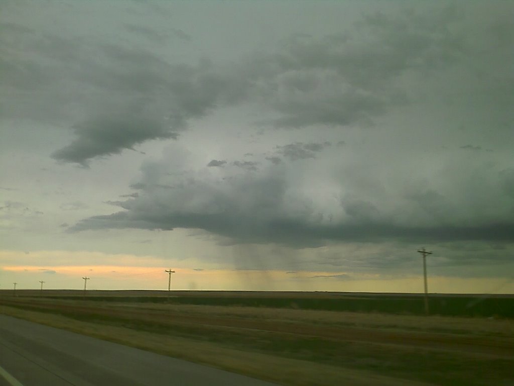
Here is the strongest cell as it heads NNE from Goodland, KS we saw a few brief spinups and near-funnels but no touchdowns.
Still glad to be out. "You gotta be in it, to win it!"

Waiting for initiation

We are south of Colby, KS in clear skies, daytime heating is rapidly increasing the instability in KS and are chances for severe storms including tornadoes is looking very good.

Morning Day 1 is out

SPC has s NE and n KS highlighted today for a 10% tornado risk! This is keeping with what they had for last nights 6Z run. Sitting in Colby, KS this morning under a deep cloud canopy and wet grounds from overnight convection. Key today is getting on the nose of the clear slot and chasing secondary convection that forms in that nose.

Friday, March 23, 2007

ETA/NAM for Sat Mar 24, 2007


ETA/NAM for tomorrow looks very nice with a jet streak nosing over SE surface winds with Tds approaching 60. SPC has the area in 30% hatched severe risk for tomorrow, chances for tornadoes right in our backyard of western KS!

Bedding down for the night in Colby, KS

The three of us are staying overnight in Colby, KS in western KS. Looking forward to tomorrow!

Eastern CO in March!

Michael, Eric and I are out on I70 getting into position for tomorrow. Will stay over night possibly in Colby, KS

Thursday, March 22, 2007

Weds March 28th Possibilty


GooFuS has slowed down the system that was to come into the plains on Tuesday to now arrive on Weds March 28th. Chris Rozoff's friend who was a student at OU has said that the last time he saw a setup like this was May 3rd, 1999. That's the date of the OK outbreak and the Moore, OK F4 tornado.
Keeping a definate eye on this one. I already have Tuesday off work and may be requesting Weds off as well if the models hold over the weekend.
Saturday looks promissing for a chase closer to home in w KS down into the panhandles. May leave as early as Friday night. Michael and Eric be ready to leave at 5pm friday and be out till possible Sunday night.

2007-03-23 Report

Intercepted the line of cells that formed in roughly a line from nw of Omaha to nw of Lincoln, NE. Saw a few breif spinups including the northern most storm that exhibited some supercellular structure with 80 gate to gate shear markers on it for a time. Chased for a bit with John and Michael O'Keefe, also met Pete McConnell at Strang, NE. Was a fun chase but a long drive at nearly 1300 miles. Left Denver at 8am MDT and arrived back home the next morning at 3:00am.

Wednesday, March 21, 2007

Almost to Salina, KS

Just crossed the dryline at Hays, KS and are now approaching Salina, KS. Our target is Concordia, KS. We have a nice aggitated CU field in front of us and some sort of cloud bank to our north. Could be the nose od a dryline buldge.

Tuesday, March 20, 2007

"The Target Remains"

The 12Z WRF/ETA model run is out and my target from yesterday 'remains' to the north of Russel, KS. If I had to pick a town, I'd say somewhere near Concordia, KS. The road networks in this area area good in case we have to go north. Everything is set to get up at 5:00am tomorrow, pick up Michael in Lafayette and be on the road by 6:00am. Concordia is 7 hours away so that should put is at the target area at 2:00pm CDT with a couple gas stops along the way. Tony, Jon, Tom and Jenn are meeting at the Airport P&R at 6:30am on I-70 so that will put us all on the road at about the same time.

Only fly in the ointment that I can see in the latest model run is the 500mb winds are a little lighter than previous runs, hopefully we'll see those kick in stronger than progged.

Cap could be an issue as the 'significant' cap line runs through Salina, KS and points south so we're pretty close to it. 6-7 C at 700Mb is the rule here according to Jon Davies site: http://members.cox.net/jondavies1/700mbTcap/700mbTcapguide.gif

Excited to be out again on the first full day of spring and almost one full month after our successful tornado intercept on Feb 23, in McLean, TX

From the HASTINGS, NE HWO:

SEVERE THUNDERSTORMS ARE POSSIBLE WEDNESDAY AFTERNOON AND NIGHT. THE STORMS WEDNESDAY WILL HAVE THE POTENTIAL TO PRODUCE HAIL IN EXCESS OF ONE INCH IN DIAMETER...WIND GUSTS GREATER THAN 60 MPH AND ISOLATED TORNADOES. THUNDERSTORM CHANCES INCREASE AFTER 3 PM AND CONTINUE INTO THE OVERNIGHT HOURS. CONTINUE TO MONITOR THE LATEST FORECASTS FOR UPDATES ON THIS POTENTIAL FIRST SEVERE WEATHER EVENTOF THE SEASON.

Monday, March 19, 2007

Target for Weds March 21st


Ok after looking at the latest WRF and GFS runs (which are in fairly good agreement) I have come up with a target as shown above. To me it looks like the area near the triple point in the warm sector has the best dynamics overall. At 0Z there's a shortwave nosing in right as capes are maximized. Target as of now: Hill City to north of Russel, KS (of course that could change!)
On the upside of this target - we could leave Weds morning and make it easily to the target and save a night's motel cost.
HAZARDOUS WEATHER OUTLOOK NATIONAL WEATHER SERVICE HASTINGS NE
SEVERE THUNDERSTORMS ARE POSSIBLE WEDNESDAY AFTERNOON AND NIGHT. THE STORMS WEDNESDAY WILL HAVE THE POTENTIAL TO PRODUCE HAIL IN EXCESS OF ONE INCH IN DIAMETER...WIND GUSTS GREATER THAN 60 MPH AND ISOLATED TORNADOES. THUNDERSTORM CHANCES INCREASE AFTER 3 PM AND CONTINUE INTO THE OVERNIGHT HOURS. CONTINUE TO MONITOR THE LATEST FORECASTS FOR UPDATES ON THIS POTENTIAL FIRST SEVERE WEATHER EVENT OF THE SEASON.


Sunday, March 18, 2007

Looking ahead at next week

Sitting in Golden this morning at Big Daddys bagel shop enjoying the nice weather and thinking about the upcoming week.


Everything looks for a chase starting Tueday night into Friday with a return to Denver Saturday!

But wait! What's this out on the end of the GFS for next Tues Mar 27th? Another big system landing in western Kansas. This could be the next one after this week!

Wednesday, March 14, 2007

Weds now on the UCAR GFS site


GFS tonight shows a 1000mb surface low over sw KS, 60 Tds up to the KS/OK border and a nice digging trough over the west.
Interestingly, even Tuesday Mar 20th has this setup although with the upper trough slightly further west. Jeez, now we're looking at Tuesday thru Saturday as chase days!


Multiple days of chasing next week

The GFS model continues to show weds to fri and possibly even sat as chase days in the southern plains. The upper level 500mb winds show a digging trough into NM and TX even though it is a little dissorganized. The GFS wants to break this trough completely from the polar flow but can't seem to quite do it yet. I think as we get closer to next week the models will pull the main upper flow into this trough and overall strengthen it.

The trend at the lower levels is for more cape and higher dewpoints into the panhandles and western OK. Capes are now above 1500 J/kg and apporaching 2000 into TX.

With this I have submitted my vacation request for Wed, Thur and Fri! I would be ready to leave Tue night and be out until Sunday so I am good to go on what looks like a great back-to-back-to-back-to-back chase setup!~

Tuesday, March 13, 2007

Nice sunset

Trying out some more panorama shots from my mobile phone. Got this nice sunset tonight from my deck!

Monday, March 12, 2007

Weds Mar 21st holding in there


Been watching Weds March 21st for a few days now and there's good news and okay news. The okay news is that the 500mb negative trough that I was seeing early on is now a much weaker cut-off low. The good news is that the return flow off the gulf is awesome! Nice theta-e air advection is all the way into SD and down into the TX panhandle with capes of 1000 - 1500 J/kg. This first day of what could be a weds/thurs/fri event would possibly be in western KS!

Sunday, March 11, 2007

Panorama from my deck

Ok the panorama below was pretty bad lighting. This one is a little better. The view from my deck looking east out over Denver. Enjoying the extended daylight today and looking forward to a possible chase starting on the 21st or 22nd!

Saturday, March 10, 2007

Dumping snow at our house


It looked like the sun would peek out and we'd get a nice warm day but now snow is coming down in big paper plate sized flakes! Winter's not done with us yet.


Oh and what's this, way out on the GFS potentially hitting the plains Weds March 21st?? A nice negatively tilted trough coming into the west coast! Have to keep an eye on this one.

Panorama blogging from my cell phone!

Testing out panorama shots from my cell phone!

Thursday, March 08, 2007

Early signs of convection in Denver, CO

A weak cold front is moving across Colorado today bringing with it a little lift and some signs of convection. Things I like to see each year around this time.

Wednesday, March 07, 2007

Trying new data sources

So yesterday I looked into the SpotterNetwork after hearing good things from Al Petrycha at the NSCC in Feb and on the compatibility chart it shows StormLab as being the app with the most green checked items for compatibility.

I went ahead and ordered a copy of StormLab and Interwarn. Both products I found were distributed (and maybe written by) meteorogist Evan Bookbinder. I had sent Evan copies of the Storms of 2004, 5 & 6 late last year to be used as spotter training material.

So today in my inbox I have my new authorization codes for both products and will be installing them over lunch and seeing how they work.

I’m still on the fence about what to do with wxworx which has been a great tool and continues to be. I think this will be a transition year for my data sources as I field test cell phone provided data thru StormLab/Interwarn and XM satellite data thru Baron wxworx. I lknow that the Cingular coverage map has large holes in w NE parts of SD and some areas off the interstate in w KS. All areas I find myself in often during chase season.

Tuesday, March 06, 2007

Next chase March 16th?

Looking ahead at the GFS there appears to be the possibility of a chase in the March 16th timeframe. This would work out well since it would make it a weekend chase with a Thursday night departure and return sometime on Saturday or Sunday.

Yesterday I had a doctors appt in Boulder so I took the opportunity to try mobile internet access through my cell phone and laptop. I had previously found instructions on the web on how to setup the phone as a wireless modem. I have to say it was very cool to be able to be logged into all my email accounts, have AIM up and be able to see websites on the road. This will make it very handy to keep in touch while out storm chasing.

I have been working on a mobile webpage that has all my favorite links on it. It is formatted to be the width of my mobile phone but can also be displayed on my laptop for quick access to all my data. http://www.stormchaserco.com/mobile.html

The Carlsons', Verne, Michael and Eric

The Carlsons', Verne, Michael and Eric

Contact Me for Helicopter Shots!

Flying Monkeys

My Blog List

Blog Archive