KRDO ColoSprgs Storm Chasers!
KAKE Wichita Storm Chase Team!

Denver's Channel 7 Storm Chasers


Tuesday, February 28, 2006
AFD from Topeka, KS for the weekend
AFD from Oklahoma City, OK for Mar 4th
AFD from Wichita, KS for Saturday Mar 4th
Monday, February 27, 2006
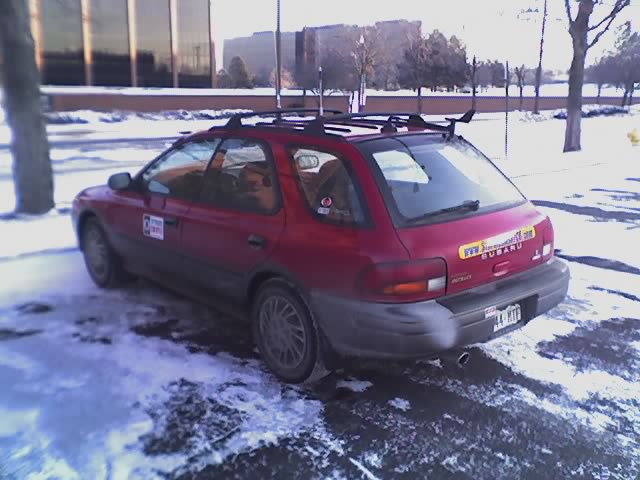
New windshield for the Sup'aru

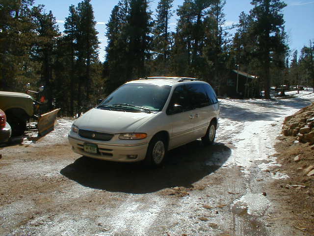
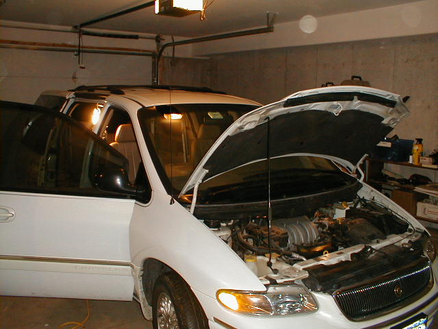
Latest image from Verne's mobile picture phone. Tempting fate from a gravel truck or hail core I went ahead and got a new windshield for the Sup'aru. The clean optical glass will be good for shooting video through.
Tony just sent this out about this weekend from the Wichita, KS WFO:
FRIDAY NIGHT THROUGH SATURDAY NIGHT: WINDS WILL SWITCH TO THE SOUTH LATE FRIDAY AND WILL PERSIST THROUGH SATURDAY EVENING. THIS WILL DRAW UP MOISTURE FROM THE GULF AND ALLOW DEWPOINTS TO RISE DURING THE DAY SATURDAY INTO THE 50S. THE MOISTURE TRANSPORT AND ISENTROPIC LIFT FRIDAY NIGHT INTO SATURDAY MORNING IS EXPECTED TO RESULT IN A FEW THUNDERSTORMS. THE MOISTURE RETURN SATURDAY WILL ALLOW FOR INCREASED INSTABILITY ACROSS THE AREA AND AS A DRYLINE PUSHES EAST SATURDAY AFTERNOON/EVENING SHOULD HELP SPARK A FEW THUNDERSTORMS. THE LIMITING FACTOR RIGHT NOW APPEARS TO BE LACK OF UPPER LEVEL SUPPORT BUT LOW-LEVEL SHEAR IS IMPRESSIVE. WILL DEFINITELY NEED TO KEEP AN EYE ON THIS DAY.
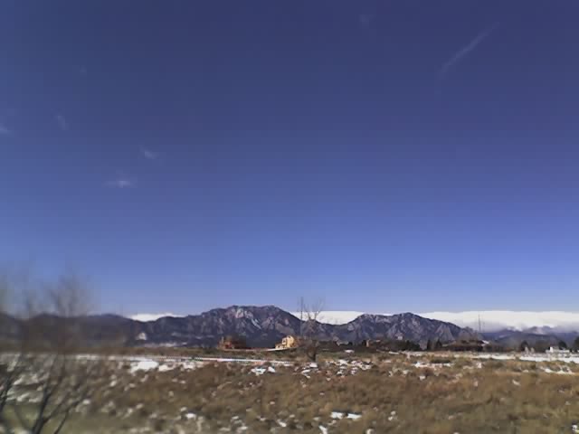
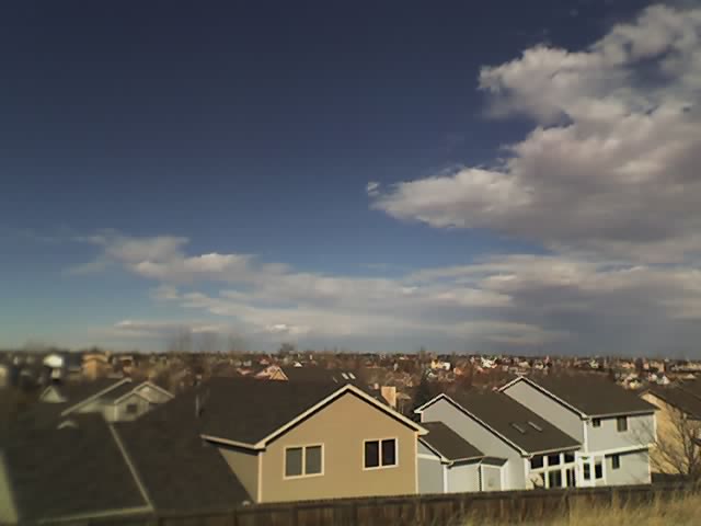
Temps near 70 in Denver!

Latest image from Verne's mobile picture phone. Yes it's still February but temps today are approaching 70 degrees!
Sunday, February 26, 2006
Leaning towards Sat March 4th
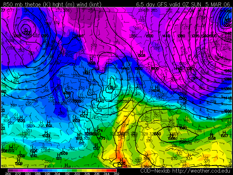
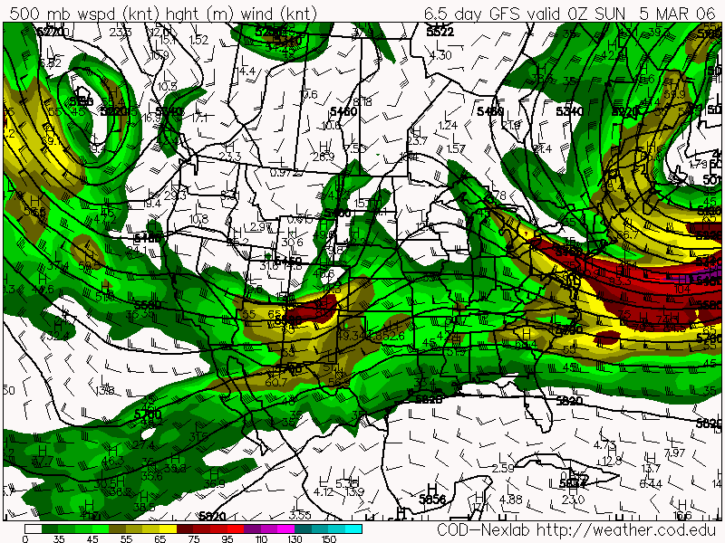
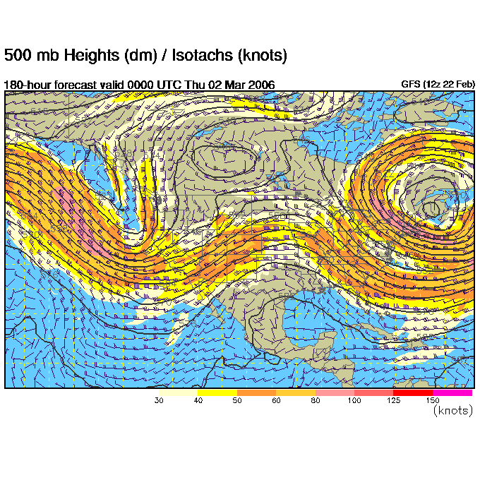
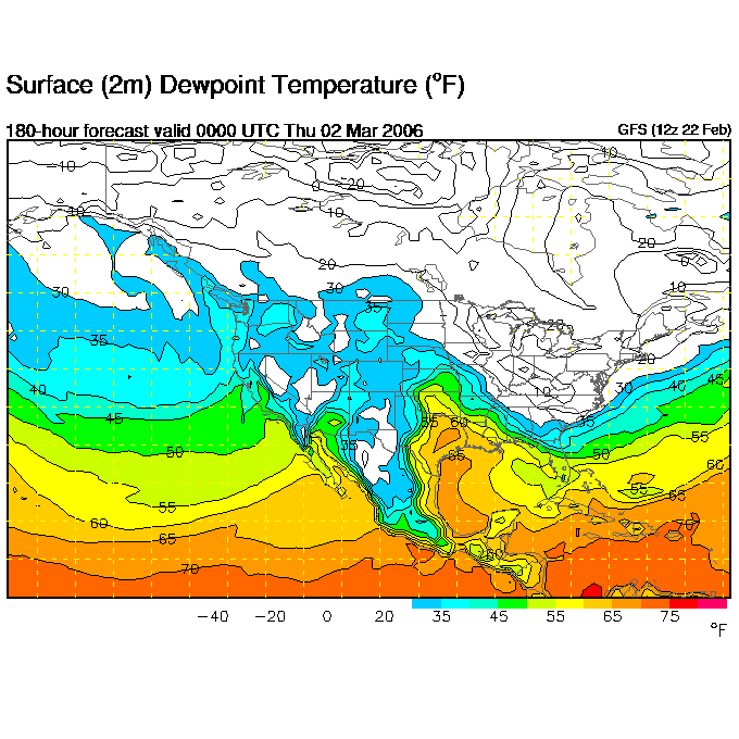
After looking at the latest GFS run I am now leaning towards Saturday March 4th as the best day for chasing this weekend. There is a nice 997mb closed surface low in western KS at 0Z with 45-50F Tds as far north as central KS. There is diverging 500mb winds over KS with nice 30-40kt veering SE winds into the surface low. Max temps that day get up to 70F. I think if the surface low forms within the requisit 200 miles from the upper low and we get sufficient warming in the clear slot we could have a classic cold core setup as described by Jon Davies.
I think Friday afternoon bears watching for eastern CO/western KS as a Day 1 event. I think we could get some weak low-topped supercells with weak cold air funnels that we often get this time of year east of Denver.
Mar 3 - Mar 5 Chase Possibility (Updated)

From this mornings SPC 4-8 Day outlook site (thanks to Tony L for turning me on to this link!)
...DISCUSSION... LATEST MODEL SUITE /ECMWF...CMC...GFS...MREF/ HAVE NOT BEEN CONSISTENT IN THE HANDLING OF THE MID-WEEK TROUGH MOVING INTO THE WRN STATES. EARLIER VERSIONS OF THE GFS ARE IN MORE AGREEMENT WITH THE 00Z MREF/ECMWF IN SUPPORTING A LESS AMPLIFIED TROUGH AND THIS SCENARIO SEEMS MORE REASONABLE. THOUGH CONFIDENCE IN THE AMPLITUDE/TIMING OF THE WAVE IS LOW...MSTR TRANSPORT WILL LIKELY INCREASE AHEAD OF THE TROUGH ACROSS THE CNTRL/SRN PLAINS THU-SAT /02-04 MARCH/. PRIMARY SFC LOW COULD DEVELOP FAIRLY FAR N ACROSS THE PLAINS WITH THE DRYLINE SWD INTO THE SRN PLAINS BY EARLY SAT /04 MARCH/. INCREASING FLOW ALOFT AND LARGE SCALE FORCING SPREADING ATOP THE WARM SECTOR SHOULD BE FAVORABLE FOR AN ENHANCED RISK OF ORGANIZED SEVERE TSTMS FROM FRI /03 MARCH/ TO SUN /05 MARCH/ SPANNING THE CNTRL/SRN PLAINS EWD TO THE MID-MS VLY.
Saturday, February 25, 2006
White Lightning build out day
Today's the day Tony L. brings up his new chase vehicle 'White Lightning' and we begin to equip it for storm season. The garage is all cleaned and swept out and ready for construction to begin!
The White Lightning ready for installation of Tony's HAM radio, CB/Weather Alert Radio, Cigarette Lighter expander and Jotto Desk.
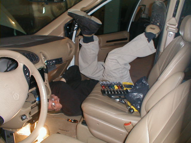 Tony doing some car gymnastics to get under the dashboard and install the HAM radio base unit.
 Installing the Jotto desk - we ran into a plastic panel covering what we thought was the metal underneath on the floor. After attempting to drill through the plastic and not hitting metal what did I decide to do in a 'genius' moment?? Get out the Sawzall and cut through the plastic. And what did we find underneath?? The chewed up wiring harness for the van that I had just cut through>!>! AAAhhhhhh!!! Well luckily the wires were all color coded and we were able to solder them all together. Everything seemed to work on Tony's van so I think we recovered from that mishap.
Friday, February 24, 2006
The Sup'aru gets my old KB0ZCQ plates

Latest image from Verne's mobile picture phone. Taking Tony L's advice I ran down to the Jefferson County DMV this morning before work and did the old swap'aru between the Exped and the Sup'aru's plates.
Out with the old...

GFS continues to show neg tilt trough for Mar 3rd
Thursday, February 23, 2006
My Favorite Slot Machine - Money Storm!

Latest image from Verne's mobile picture phone. When there's no storms to chase I like to win some chase money on Money Storm!
Wednesday, February 22, 2006
March 2-3 Chase Potential
 Posted this today on StormTrack and StormChasers Forums:
Looking way ahead at the GFS looks like we have some potential for some storms Thurs March 2 and Fri March 3. Projecting forward a day or two, the 500mb chart shows a negatively tilted trough pulling out into the plains overspreading 850mb southeasterly winds in central KS and OK. While not great, 55 Tds get up as far north as the KS/OK border.
I'm going to go way out on a limb and say an initial target of Woodward, OK for one of these days :)
Temps warm into the 40's
Latest image from Verne's mobile picture phone. After lows down to -13 temps warm back into the 40's. 60's are expected for early next week.
While I'd like to see the warmer temps we really need a good couple of months of soaking snows and rains. After the talk that Dr. Greg Forbes gave about the projections for the 2006 season I did some digging on the CPC site. Sure enough the projection for the next 3 mos shows the southern plains continuing to be dry and hot. If you believe that evapotranspiration has a role in severe storm frequency then that does not bode well for the storm season in TX and OK. Last year OK had a record low number of tornadoes. I am anticipating that we will see this trend again this year and that the big action will be in NE, SD, IA, MN and ND. I also am leaning towards another peak in activity in the first week or two of June.
Looks like Tony L will be coming up this saturday with the White Lightning van. Looking forward to doing some drilling and modifications. I also still need to find a place to mount my Davis Weather Monitor.
Sunday, February 19, 2006
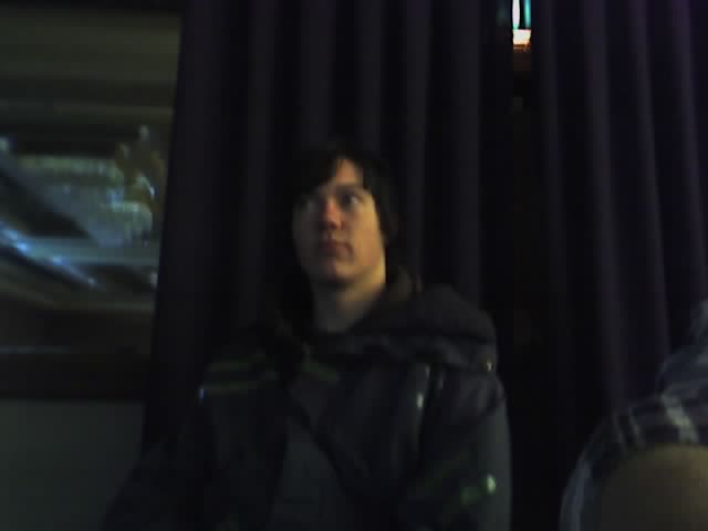
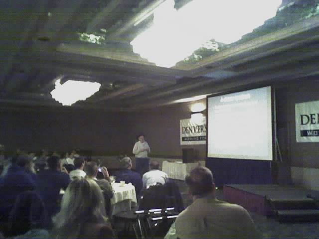
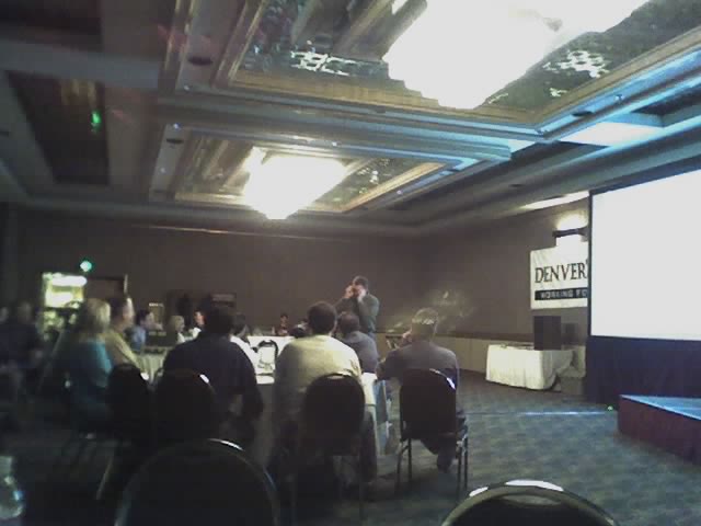
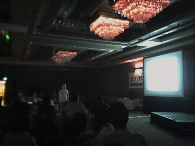
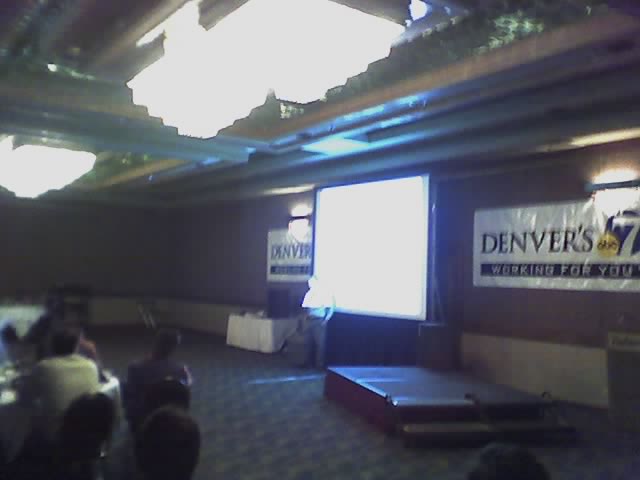
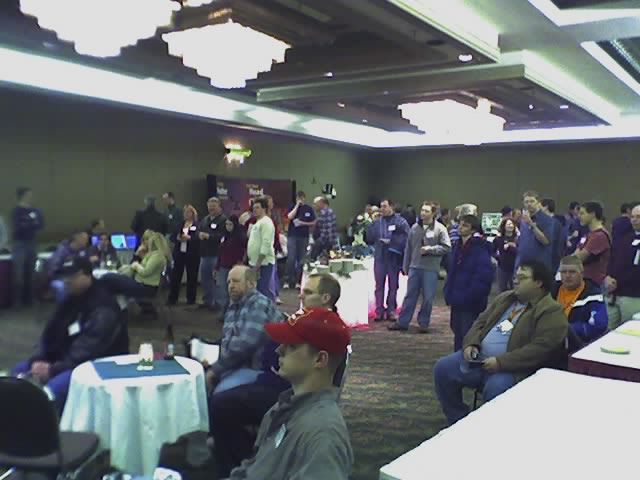
2006 National Storm Chasers Conference

Good friend and fellow chaser Tony Laubach tunes in as Tim Marshall talks about tornado damage assessment
Just got back from the 2006 National Storm Chasers conference. Thanks to Tim Samaras and Roger Hill for putting on a great event once again. It was a weekend of meeting new friends and freindships renewed! A time of year when the cold of February is thawed by the sharing of stories of warmer times in the spring when the skies put on thier annual show! It was great seeing everyone again and here's to great chases in 2006!


Saturday, February 18, 2006


Friday, February 17, 2006

Snowmobiling in Breckenridge
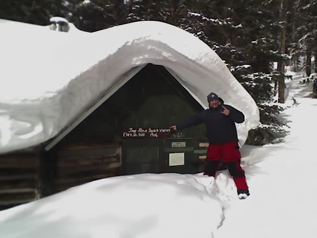
Latest image from Verne's picture phone. Doug K checks out the 1906 log home near Tony's Mine.
Amanda on her Polaris

Latest image from Verne's picture phone. Amanda waiting to go for a ride on her Polaris snowmobile.


Thursday, February 16, 2006
4-5" of new snow in Denver

Latest image from Verne's picture phone. This car was one of many that slid off the road with this latest winter storm.
Today SPC has a 10% risk of tornadoes out for western Tennessee/southern Illinois area. A GREATER THREAT OF SUSTAINED SUPERCELLS AND ISOLATED TORNADOES.

Wednesday, February 15, 2006
Technical Difficulties

Latest image from Verne's picture phone. Been having some problems posting to my blog today but hopefully everything is cleared up for tomorrow's posts.
Two more days till the National Storm Chaser's Conference in Denver, CO!
Steam cloud resembles wedge tornado

Latest image from Verne's picture phone. Although you can't see it very well, this steam cloud rising from a power plant and connecting with the stratus deck above resembled a wedge tornado on my drive in this morning. Ah if only it was really a wedge tornado!
Light snow and cold come to Denver

Latest image from Verne's picture phone. Just a trace of snow fell last night as seen from this view of Denver.
Tornadoes are possible in the St. Louis area on Thursday. Here's the Day 2 outlook applicable statement: at the present time...it appears low-level thermodynamic structure could become supportive of tornadoes in strong low-level shear regime near/southwest of st. louis mo east northeastward into parts of west central indiana. if this occurs...an isolated strong tornado is possible.
Tuesday, February 14, 2006
Monday, February 13, 2006
Prairie Dogs

Latest image from Verne's cell phone. One of the many little furry animals that live around our office.
Sunday, February 12, 2006


The Carlsons', Verne, Michael and Eric

Contact Me for Helicopter Shots!
