
KRDO ColoSprgs Storm Chasers!
KAKE Wichita Storm Chase Team!

Denver's Channel 7 Storm Chasers


Thursday, May 31, 2007
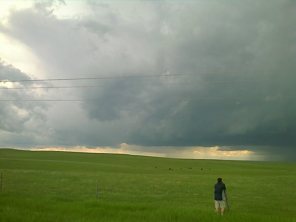
Cell going up southwest of Springfield
Moderate risk of severe for last day of May!
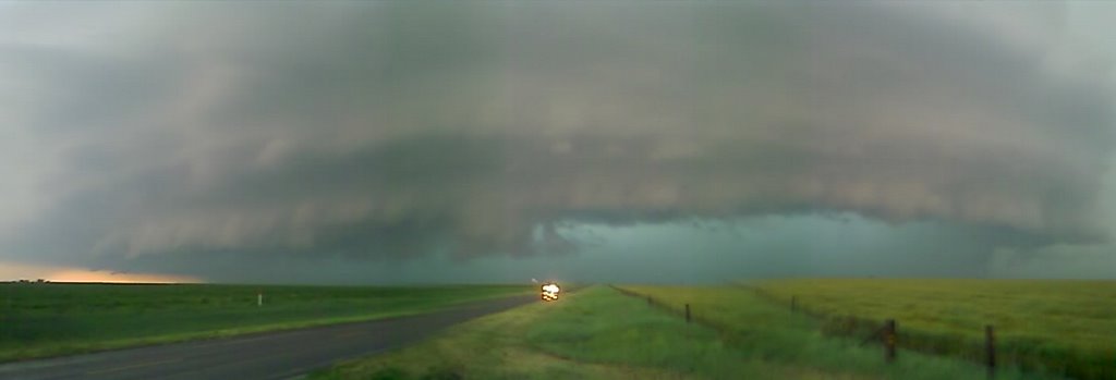
 Waking up this morning at the Comfort Inn along I-40 on the south side of Amarillo, TX. There is alot of stratus this morning and temps are cool but we're starting to see breaks in the clouds which we like to see for destabilization of the atmosphere later on today. Today looks like a good chase day with a 10% tornado risk for the panhandles as well as a moderate risk for severe storms. I have seen most all of my 29 tornadoes this year in moderate risk outbreaks bringing my career tornado total to 79!
BY MID/LATE AFTERNOON THUNDERSTORMS WILL FORM OFF HIGHER TERRAIN ALONG NERN NM/TX BORDER INTO SERN CO WHERE LAPSE RATES IN EXCESS OF 8C/KM AND MLCAPES ABOVE 1000 J/KG WILL BE IN PLACE. STORMS WILL THEN INCREASE IN BOTH NUMBER AND INTENSITY AS THEY MOVE EWD INTO THE ADJACENT HIGH PLAINS WHERE A RAPIDLY DESTABILIZING AIR MASS WITH MLCAPES IN EXCESS OF 2000 J/KG WILL BE COMMON BY 00Z. EVENTUALLY THE SEVERE STORMS ARE EXPECTED TO EVOLVE INTO ONE OR MORE MCS/S. PRIOR TO MCS DEVELOPMENT ...SUPERCELLS ARE EXPECTED TO BE PRIMARY CONCERN WITH VERY LARGE HAIL AND POSSIBLY TORNADOES.
Wednesday, May 30, 2007

Tuesday, May 29, 2007
05/29/07 - Chase Report - E CO


Chased with my Dad, Tony Laubach, DreamVisions crew, Silver Lining Tours, Jon Van De Grift, Eric Hurst and Dani Hurst, mainly chased with Tony DR and SLT. We got on the LP cell that passed over Limon Colo. The cell went OF fast and produced nice golf ball size hail.
Michael C.
Mileage: 224
Motel Stays: 1
Tornado warned cell in Elbert county CO
Four amazing May days coming up!
 Well last night storms finally fired in our target along the SD/ND border but it was well afte dark. Today we are waking up in McCook, NE to what is looking like four days of continuous storm days in the same region of se CO/sw KS OK and TX panhandles!
Here's the SPC text for today:
HOW FAR S THE COLD FRONT WILL BE PRIOR TO AFTERNOON INITIATION IN ERN CO WILL DETERMINE THE DEGREE OF SUPERCELL AND TORNADO POTENTIAL. FORECAST BASED ON THE FRONT STILL VICINITY PALMER DIVIDE BY MID AFTERNOON PLACES SE CO AND ADJACENT KS/OK BORDER AREA IN FAVORABLE SUPERCELL ENVIRONMENT. MLCAPES WILL INCREASE TO 1500-2000 J/AL MLCAPE THIS REGION ALONG WITH MARGINALLY FAVORABLE DEEP LAYER SHEAR OF 35-40KT. STORMS SHOULD DEVELOP IN RESPONSE TO FRONTAL CONVERGENCE AND OFF HIGHER TERRAIN BY MID AFTERNOON WITH ANY SUPERCELL DEVELOPMENT ENHANCING BOTH LARGE HAIL AND ISOLATED TORNADO THREAT.
Monday, May 28, 2007
Chasing today in North Dakota?
 Last night Michael, Tony L and I chased with the DreamVision team from Japan to a couple of tornado warned cells in the Ogallala and North Platte, NE areas. The storms were of the 'popup convection' type meaning they form and die on thier own rain downdrafts before they can get organized. Weak winds aloft are usually the culprit.
Today we will be following Roger Hill and the Silver Lining Tours group up to possibly North Dakota! This will be my first time to ND so I'm really looking forward to it. Tomorrow the action is back down in the Texas Panhandle so we'll have to do some insane driving to make that target tonight.
SPC's text for today: SUPERCELLS WILL BE POSSIBLE...INITIALLY...AND CAPABLE OF PRODUCING VERY LARGE HAIL AND DAMAGING WINDS GIVEN THE STEEP LAPSE RATES/MODERATE INSTABILITY. TORNADO THREAT IS EXPECTED TO BE GREATEST FROM CENTRAL SD TO ERN ND WHERE LOW LEVEL SHEAR SHOULD BE MAXIMIZED ALONG/NE OF THE TRACK OF A SURFACE LOW AND GIVEN STRONGER LOW LEVEL WINDS ENHANCING THE SHEAR IN THIS REGION.
Mileage: 474
Motel Stays: 1
Saturday, May 26, 2007
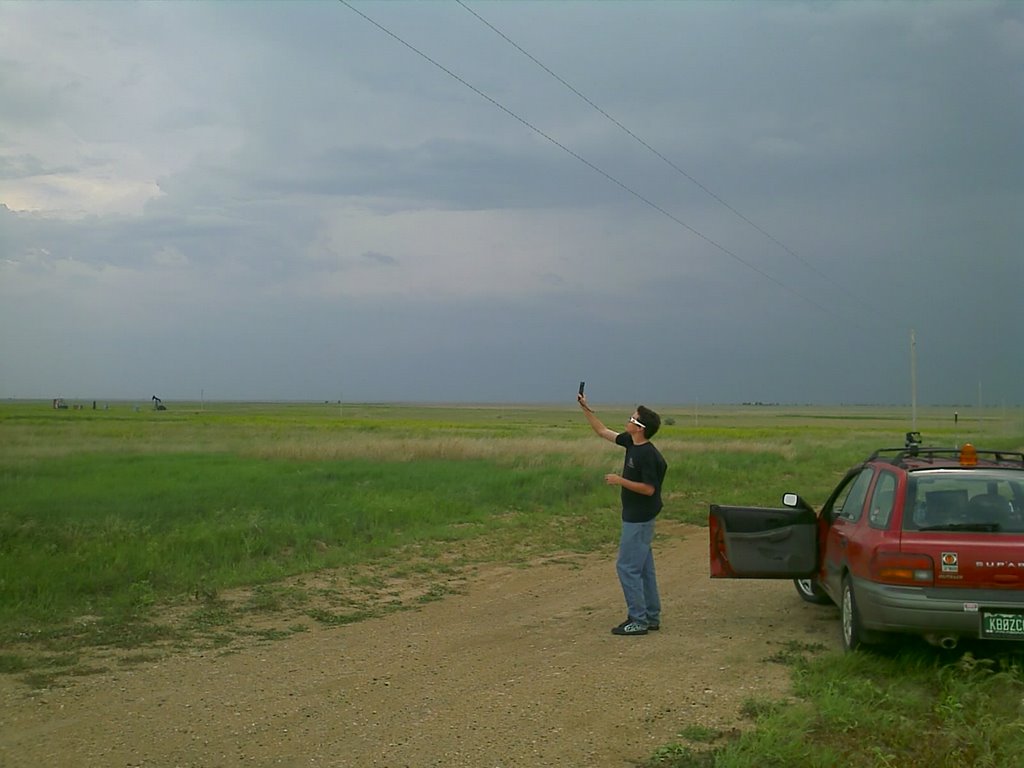
Wicked Witch Test Flights 1 and 2
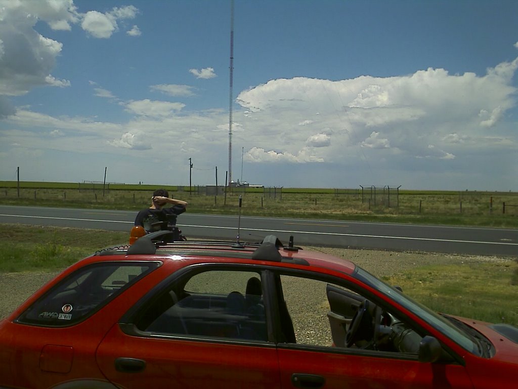
Michael and I went out yesterday and successfully flew the 'Wicked Witch' RC video plane yesterday. We chose a dirt road out highway 36 past Joes, CO where a developing thunderstorm was in the area. Winds were brisk at about 20 mph with gusts to 30. Lightning was in the area as well as light rain. Flight number one suffered from video that was not quite dialed in causing some false-color overblown video. Flight number two I failed to note that the landing from number one had thrown a layer of dirt over the camera lens.
I plan to use a video Y cable and route the video from the camera to an onboard mini-DVR to record better video quality. This will require always retrieving the plane even after an encounter with a tornado. At the minimum though, video like in the clip above can always be obtained from the transmitter in real-time.
Next steps are to gain more and more experience flying in closer to the rain free base and rotating wall clouds and then finally a tornado!
Thursday, May 24, 2007
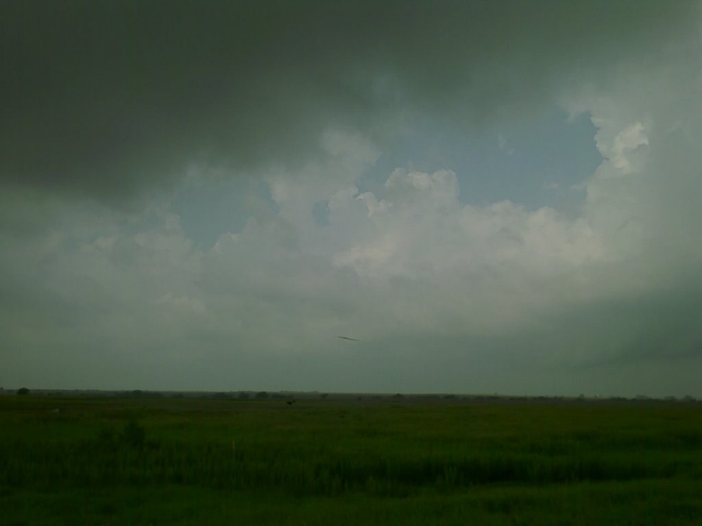
05/23/07 - Chase Report


 Got back at 3am MST to SNOW!
Chased down in the Texas Panhandle saw one brief tornado that formed 20 feet in front of our vehicle. The tornado never fully condensed to the ground but the debre cloud kicked up tumble weeds and other debre from the field in front of us.
Michael C.
2007-05-23 Report

Michael and I were on the Laverne/Buffalo, OK storm from initiation. Followed it northeast where it almost tornadoed in the pic above.
 As we followed it north to almost Buffalo we came around the corner and had tumbleweeds lofting into the air only 50-100 feet in front of us in a vigorous swirl. We counted this 30 second event as the only tornado of the day for us.
The storms to the north became weak due to anvil shielding from the southern storms so we blasted all the way down south and enjoyed the meso west of Lipscomb along with everyone else. Not a bad chase but kind of dissapointing for a PDS watch.
Mileage: 166
Motel Stays: 1
Wednesday, May 23, 2007
Huge rotating meso!
PDS Tornado Watch

Storms already firing near Pratt, KS
05/22/07 - Chase Report


Chased all over the northwest corner of Kansas and saw one tornado and a huge meso-BOMB! I have never seen structure so beautiful before, it was definitely jaw dropping.
Michael C
2007-05-22 Report
 Brief horizontal funnel at the Quinter, KS exit on I-70
 Nice cone tornado between Wakeeney and Hill City, KS! This tornado was on the ground for maybe 10 minutes and was very nice to see!
 The most amazing meso we've seen all year, this thing was jaw-dropping!
Mileage: 338
Motel Stays: 1
Tuesday, May 22, 2007
Huge rotating mesocyclone

Dorothy's house

Dorothy's House in Liberal, KS

Monday, May 21, 2007
Chase target for Tuesday May 22
 Capes over 3000 J/Kg are maximized in a line from Wakeeney, KS south to central TX.
 The WRF model breaks out one large cell over Wakeeney, KS at 0z (7pm CDT).
 500 mb winds are fairly strong and diffluent in the same area. Target for tomorrow is to start just northeast of Liberal, KS (our overnight stay tonight) and chase the cells that form on the dryline as they move almost due north to I-70. If new cells form to the south we will drop down onto them as they come north.
Severe warned cell
Mileage: 381
Motel Stays: 1
In Dalhart, TX waiting for storms
Sunday, May 20, 2007
Chase Potential Monday May 21
 Nice focused cape along the dryline. Areas north are very diffuse.
 WRF breaks out precip along the dryline at 0z south of Amarillo, TX
 For tomorrow I am favoring the area south of Amarillo for a target. There is a subtle wave at 500 mb coming in at 0z in the area and the WRF is showing a nice couple of cells breaking out in the area. Capes are focused well along the dryline in this area whereas areas north are more diffuse.
Saturday, May 19, 2007
Erie, CO Balloon Launch
 Balloons float off the southwest of Erie, CO
 This big dragon was a crowd favorite!
 Got up at 4am this morning so I could get down to Erie, CO where they are having a mass Hot Air Balloon launch. It was quite a site. I had a great vantage point on the grass as they all lofted into the air within 20 minutes of each other. I've never seen this many go up at the same time. A lot less hectic than photographing tornadoes!
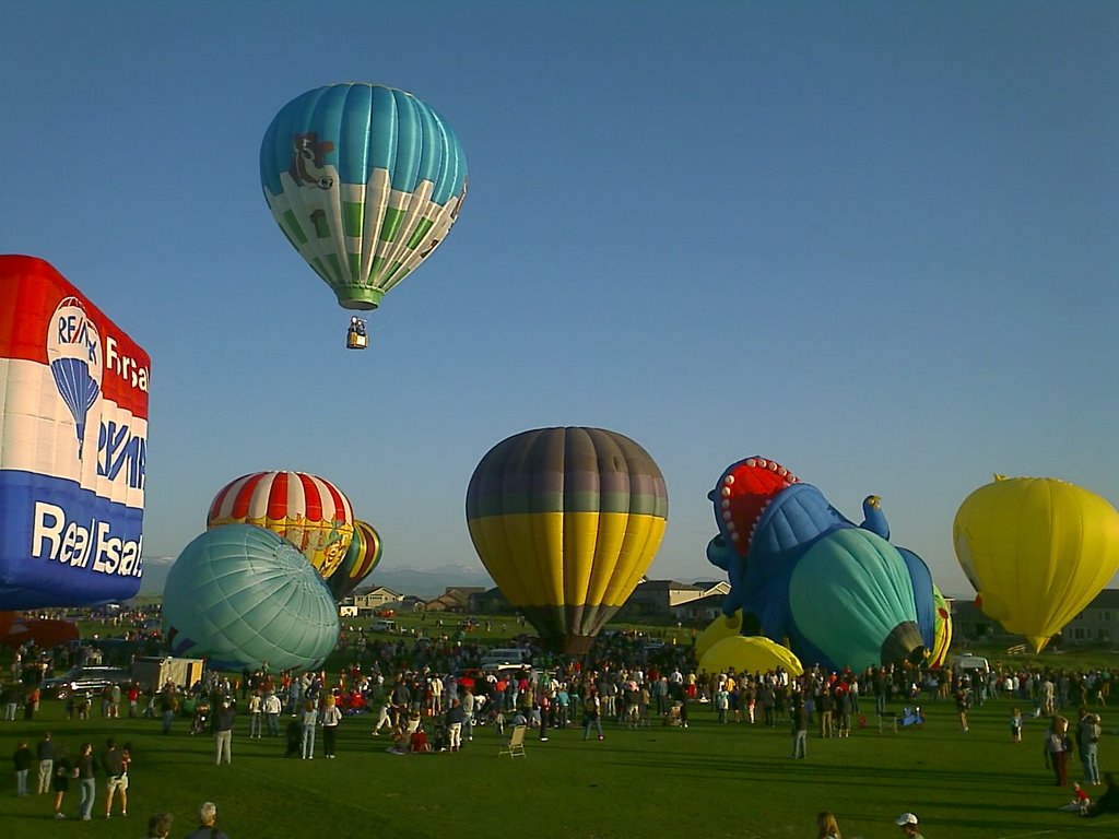
Photographing the Erie Balloon launch this am. What a site! Over 60 balloons all going up at the same time.
Friday, May 18, 2007
Wicked Witch top wing panel
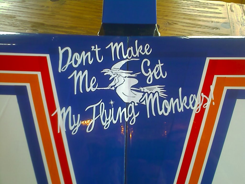
Bad weather permitting I will be lofting this plane into a tornado sometime this season!
Don't make me get my flying monkeys!
Wicked Witch Video System

The video system on the Wicked Witch is a 3500mW transmitter broadcasting on the amateur TV band of 1.2 GHz. The camera is full motion color and can be independently pointed while in flight. In this way, I can keep the tornado in the video frame even if the plane wants to orbit in a circle as it gets drawn into the inflow. At some point the infow should be so strong that the plane breaks apart as it enters the tornado. Hopefully the video system will keep transmitting as long as possible up to this point.
Make no mistake about it. This is a suicide mission for the plane.
Subscribe to:
Posts (Atom)
The Carlsons', Verne, Michael and Eric

Contact Me for Helicopter Shots!
