Live Geo-referenced Storm Chaser Video. First in the Field Aerial Live Streaming and Aerial Storm Intercepts. High Resolution Level II Radar Data. Severe Weather Forecasts and Reports by Storm Chasers/Severe Weather Videographers Verne, Michael and Eric Carlson. For live stream and video licensing contact us at: vernecarlson@hotmail.com

KRDO ColoSprgs Storm Chasers!

KRDO

KAKE Wichita Storm Chase Team!

KAKE

Denver's Channel 7 Storm Chasers

KMGH 7 News

License this Live Stream Now!

Follow us LIVE on iMap Tracker! When you see a car we are live.


Friday, August 31, 2007

Lightning Over Broomfield


Just got home from an awesome light show over Broomfield, Colo. I am so happy that all the Colorado chasers got shots and made it out to see the lightshow!

All the Carlson Chasers were out catching lightning tonight!


Michael got these lightning shots tonight that were shown on the 10pm weather tonight by Mike Nelson.

Some Lafayette Lightning

Had a weak storm right outside my window today with some brief lightning, so I got the video camera out. Here's some stills from the tape:


Wednesday, August 29, 2007

Severe warned cell

The storm near Ft Lupton has now gone severe. I haven't seen strong convection like this in awhile!

Nice storm over Ft Lupton

This cell just popped up northeast of town. Also rock hard convection just south of it as well.

ARAPAHOE BASIN NEARS COMPLETION OF MONTEZUMA BOWL EXPANSION


Montezuma Bowl expansion will increase the ski area's terrain by 80 percent this coming ski season. The 400-acre Montezuma Bowl, located on the backside of Arapahoe Basin, will be the nation's largest terrain expansion for the 2007-2008 ski season. The bowl is scheduled to open for the holidays in late December.

The new terrain will include blue, black and double black slopes for a total of 36 additional runs. The skier and rider will discover cornices, chutes, glades and wide-open bowls. Several runs will be groomed nightly, providing the intermediate guest with much coveted additional cruising terrain. Hike-back terrain past the lower lift terminal will also be available for the adventurous skier or rider who has more interest in experiencing a remote, back country feel.

Read all the details here: http://www.arapahoebasin.com/?page=site/text&nav_id=c4e3ab196d4881e6dddcc80b6dfdbf1a

Tuesday, August 28, 2007

Tuesday morning Lunar Eclipse


Tonight we had a rare treat, a total lunar eclipse visible from the western hemisphere. These shots were taken from my house in Coal Creek Canyon, CO between 3:45 and 4:00am MDT.

Friday, August 24, 2007

Crazy night of lightning!


After chasing the storms out by Limon, CO thursday, we got a second line of storms the came through last night. This was one of the most intense nighttime lightning displays we've had this year. I was up till 1:30am last night and here are some of the best shots!

Thursday, August 23, 2007

Severe warned cell in Elbert county

Got this lightning shot from I70

Mileage: 240

20070822 Chase Report.


I chased yesterday with Dann Cianca up by the Cheyenne Ridge in WY. We intercepted the cell drifted north of Cheyenne, WY. It developed a really nice wall could and for about half an hour had an awesome striated meso. We followed the cell until we hit Hwy 85 and by that time the cell went outflow dominant and died off. We dived south to get on a cell that had came out of Fort Collins, CO. We swept the mind field and got the biggest hail I had ever encountered! The hail ranged from dime size to a little bit bigger then golf ball size. Thanks to Mike O'Keeffe for nowcasting!

Michael C.

Wednesday, August 22, 2007

Golfball hail west of HW71 at NE/CO border

Big whistling hail just hit me! Golfball sized hail came down for many minutes from the storm below just across the CO/NE border west of HW71. I have a huge new dent on the roof of the Subie as well as many smaller new dents on the hood.


Here is the video taken about a half hour after the hailstones above. There were fairly strong outflow winds at the time allowing me to 'kite' the WW3 into the wind and use a forward view. I was able to capture at least two lightning strikes and the rainshaft curl hitting the ground as a microburst.

Mileage: 444

Nice vault!

This is a view of the tail end storm today south of Bushnell, NE. After the hail above fell and I met up with Michael, Dan and chasers from UNC I flew the WW3 in this storm with the DVR cam for about 15 minutes. Caught a nice rain shaft with micro burst curl, scud tags and at least one lightning strike.

Severe warned cell

Northeast of Cheyenne, WY

Saturday, August 18, 2007

Aerial photography with the WW4

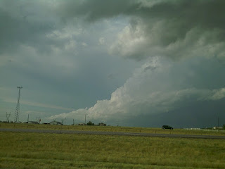
This morning I flew my Nikon Coolpix L3 camera pod on the Wicked Witch 4 and I can't be more happy with the results. This will allow me to take some interesting storm structure shots from hundreds of feet in the air and to be able to fly the damage path of tornadoes to take low cost aerial photos of the damage done and scour marks on the ground!

Image Dimensions: 2592w x 1944h
Image Size: 5.1MP

Stay tuned for more photos!

Looking off to the east from the foothills of Colorado. That is Coal Creek cutting across the bottom. Broomfield, CO is out in the distance. This was at the maximum height for this flight of about 500 feet!

The Subie parked next to Plainview road from a couple hundred feet in the air.

A nearby house captured by the WW4 using the Nikon camera pod.

Thursday, August 16, 2007

Chase Report - 20070815


The one day time lightning shot I got, look closely


Fun little backyard chase. I left Broomfield around 11:30 and headed south to met up with the cell coming out of the mountains near Castle Rock. I had to do a lot of catching up and core punching to get around to the good side, but once I did I was amazed to see how photogenic this cell was. I followed it out east as it went south of Limon and by that time had went outflow. The lighting associated with this storm was unbelievable I manged to get a shot in the day time of a bolt hitting out in the field in front of me. I decided to gas up in Limon then head south a ways and wait till dark to get some of the amazing lighting. I sat near Boyero on a dirt road where I met Ryan Shepard and Lizzie Croswhite, two UNC chasers from Greeley. We chased south as a new cell formed and indicated a meso on the southern side. After making a bit south I decided to set up for lightning. The lightning I did get was mostly anvil crawlers and not so much CG's but managed to get one good one. Thanks to Mike O'Keeffe and Dann "The Weather Man" Cianca for now-casting for me!

Michael C.

The Carlsons', Verne, Michael and Eric

The Carlsons', Verne, Michael and Eric

Contact Me for Helicopter Shots!

Flying Monkeys

My Blog List

Blog Archive