 Hail damaged vinyl sided house in Wheat Ridge, CO N39 46.69 W105 7.37
 Audi that had a tree limb fall on it's back window. N39 46.04 W105 7.24
 Garage front taken off by large tree. N39 46.04 W105 7.24
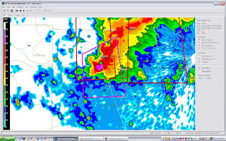
 Reflectivity screen grab at 10:25pm MDT.
 Velocity screen grab at 10:31pm MDT.
 Vertically Integrated Liquid at 10:26pm MDT.
 Tree limbs up to 4" diameter down along Ward Road. N39 47.96 W105 8.31
 N39 47.96 W105 8.31
 These 4 photos were between Kipling and Ward Rd on CR 58. N39 46.71 W105 7.46
 News crews filming CR58 road blockage.
 Large 40 foot high tree uprooted and across CR58.
 Last night's storm tore through the west Denver suburb's with extreme force! I was shooting lightning shots from my deck but the line of storms that moved from Boulder to Castle Rock where so low to the ground that there were absolutely no CGs to capture.
At 10:45pm or so the west most cell went tornado warned so I hopped in the car and headed down to live stream the damage! Above you can see the deep hail drifts and large trees downed.


No comments:
Post a Comment