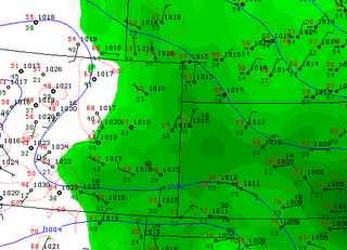
Today is another chase day in e CO with SPC upping the tornado probs from last night to 5%. Last night Tony L and Chris R's persistence paid off as the high based cell moving east across CO took a right turn and got some great structure out near the CO/KS border. I suspect that today will evolve much like yesterday, so the plan is to head out afternoon east of Denver and wait for a tail-end storm to develop near the Limon area.
Right now Tds are marginal and winds are not yet out of the east on the plains so I'll be looking for those to start lining up before making any final decisions.
Edit: Tds are up to 56 in Burlington with 61 backing it up into KS so if that can advect further east I think it's going to be a good day!
From the DEN HWO: ISOLATED THUNDERSTORMS WILL DEVELOP OVER THE MOUNTAINS AND FRONT RANGE FOOTHILLS BY EARLY AFTERNOON...THEN SPREAD ACROSS THE PLAINS DURING THE REST OF THE AFTERNOON AND EVENING HOURS. STORMS WILL BECOME MORE NUMEROUS AND STRONGER AS THEY MOVE EAST OF THE URBAN CORRIDOR WHERE HIGHER LOW LEVEL MOISTURE LEVELS EXISTS. SOME OF THE STORMS MAY BECOME SEVERE WITH LARGE HAIL UP TO 2 INCHES IN DIAMETER AND DAMAGING WINDS. DUE TO THE STRONG LOW LEVEL SHEAR IN THE ATMOSPHERE...ISOLATED TORNADOES ARE ALSO POSSIBLE. THE BEST CHANCE FOR SEVERE STORMS WILL BE EAST OF A LINE FROM LIMON TO GREELEY
DEN AFD: BEST CHANCE FOR SEVERE STORMS WILL BE JUST EAST OF THE URBAN CORRIDOR WITH THE POTENTIAL FOR LARGE HAIL AND DAMAGING WINDS. GIVEN THE AMOUNT OF SHEAR IN THE ATMOSPHERE...THERE IS THE THREAT OF EVEN A TORNADO OR TWO OVER THE PLAINS.


No comments:
Post a Comment