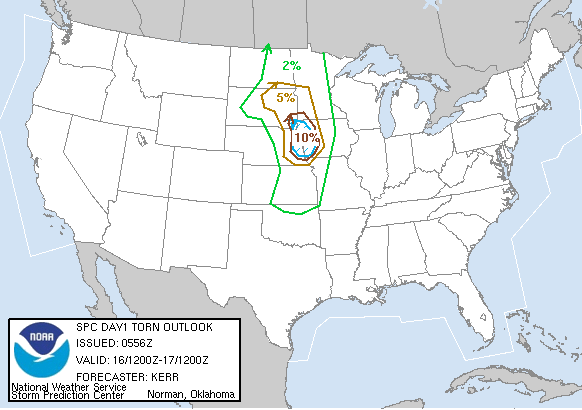

Tonight we are staying overnight in Missouri Valley, IA along I-29 between Sioux City and Omaha. We are right in the dead center of the 10% hatched tornado risk SPC put out for Saturday!


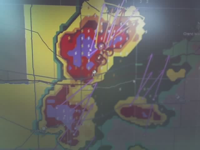
Latest image from Verne's mobile picture phone. This cell went on to produce F2 tornado damage in the town of Surprise, NE (of all places) Our route took us:
Started in Wakeeney, headed north on 283 and then over to 183 through Alma, NE
Then we went through Holdredge to Hastings, NE where we drove past Tim Marshall watching a rapidly rotating tail-end-charlie that came very close to dropping a funnel many times.
We then got up to I-80 where we took the Seward exit and got cored by intense rain on Hw92
We made it into Omaha ahead of the now MCS line, where we had dinner at the Toca Bell.
We watched a flying eagle approach Lincoln so we decided to shoot for that - as soon as we got down infront of it where it could pass by us, it weekened and died off. Watched lightning all night and then bedded down east of Blair, NE (home of Mike H!)
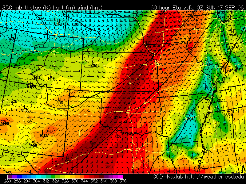
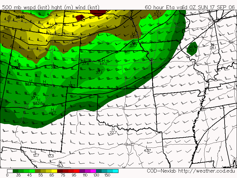 For saturday I'm seeing two target areas for tornadoes. One is hopelessly far up into MN and northern IA and one is less certain in e KS but more obtainable from Denver. A few days ago Tom Dulong sent out a similar setup day in a past Oct tornado day that showed a number of brief touchdowns nearer the surface low in Wisconsin BUT a greater number of longer lived tornadoes in e KS. If the dryline forcing can overcome the stouter cap over e KS then we may get some good discrete supercells in the area south of Topeka, KS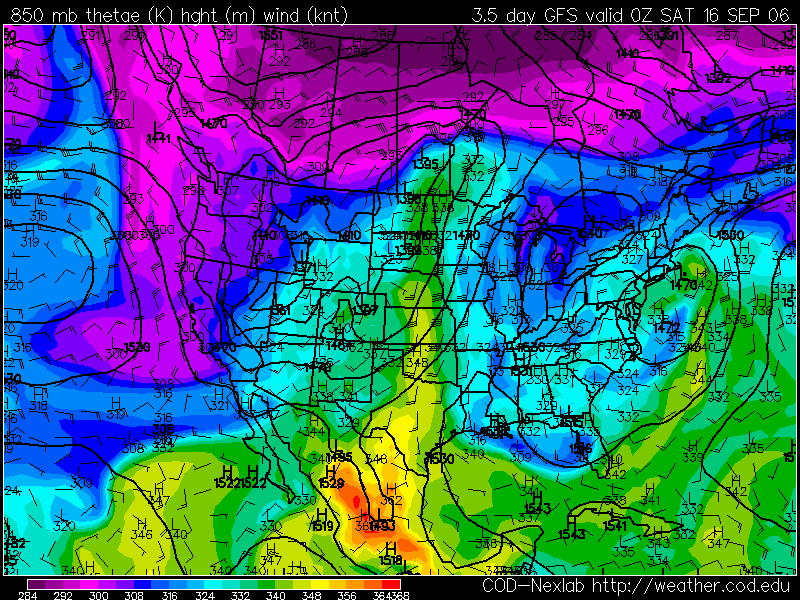
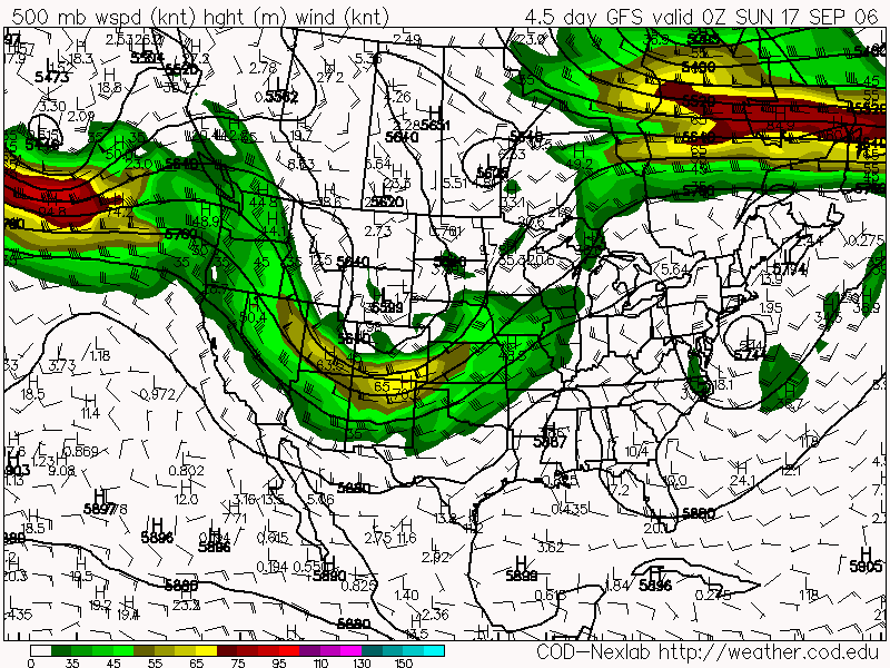 Latest GFS run is showing a trough strengthing on Saturday evening from nc KS into central NE. Most chasers are watching this one closely and there is alot of excitement about this day. This would be my first chase in September and one day after my birthday. A tornado or two would make it a great birthday present.
 Tonight I completed making a prototype of the Tornado PoleCam. Using a velcro strap and single sided sticky velcro I created the version you see above. Some further ideas I had are to shrinkwrap the camera to the velcro to make it more rain resistant. The wireless security camera I have chosen seems to be pretty tightly sealed so I think that it will do pretty well against it's short life in the storm environment.
 This weekend I plan to build another version of the wireless Tornado cam. Many of the country roads we chase tornadoes along have telephone poles and fence posts along them. This cam would be sewn into a velcro strap along with it's 9V battery. To deploy I will slap it up as high as I can on the pole and point it towards the approaching tornado. I would hope to get video as long as the velcro holds and the pole is not knocked down!

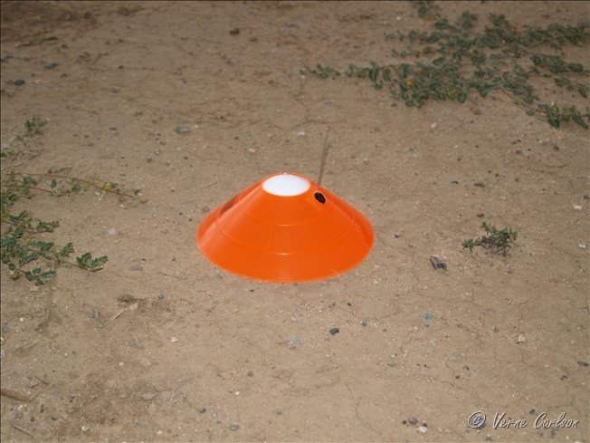
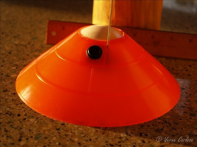 Simplicity is the key here. The MiniTurtle is made from an orange soccer cone and the top of a wiffle ball cemented into place on the top. The off-the-shelf security cam is then mounted inside and powered by a 9 V battery.
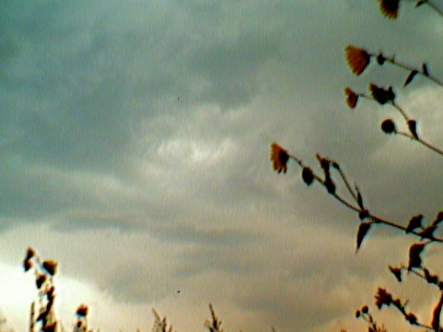
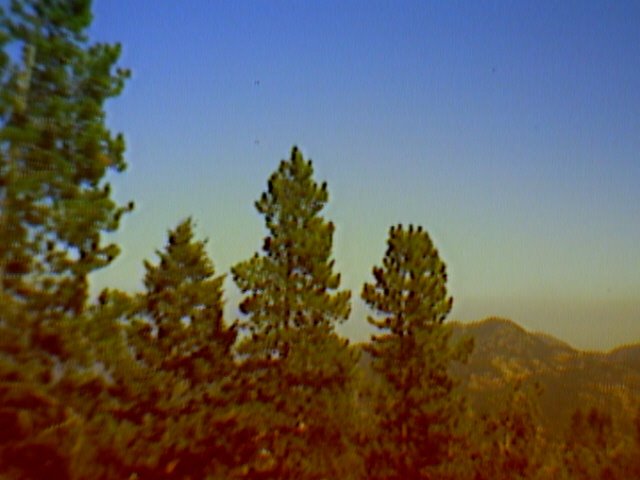 Grabbed this quick image from the MT camera. This gives an idea of the potential resolution that can be obtained. This image is 640 x 480 pixels.

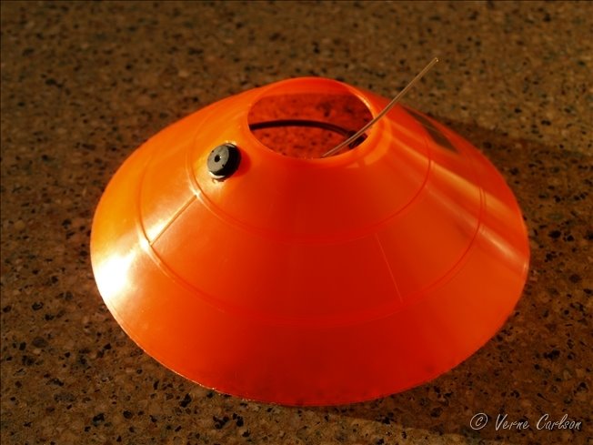 I've been working on a prototype mini-turtle video probe for deploying next year in the path of tornadoes. This morning I completed a first attempt. Borrowing from the great design of Tim Samaras' HITPR probes I have come up with a version that is much smaller, simpler and best of all wireless. This probe will use an off the shelf wireless security camera running off a 9 volt battery which will allow me to put the minimal amount of equipment in harms way and to have all the recording equipment and receiver safe in the car with me. They will be so small and inexpensive that if it cannot be found after the tornado passes then it is no big deal. They are expendible. I will also be able to stream video directly to my laptop as AVI or WMV files so conveivably with a wireless cell phone connection I could stream it to a website in real-time!
 The storm really intensified as it neared Limon, CO. We met up with Jon M and Shawn along hw71 here.
 Storm crosses hw 71 north of Limon, CO. Golfball size hail was reported south of Limon.
 Michael and I check out the forward flank shelf cloud with many eddies in it and spinups.

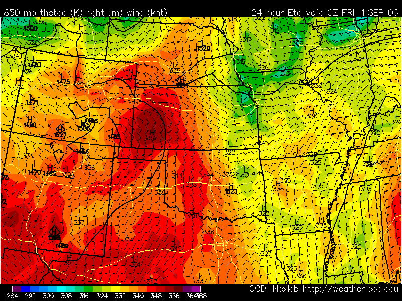 Models are showing storms firing over the Palmer Divide and heading east from 5:00pm to 10:00pm at night. Michael and I will be going out and chasing supercells. We should atleast get some good lightning shots!
 ...CNTRL HIGH PLAINS... WHILE STRONG MOISTURE RETURN DOES NOT APPEAR LIKELY ACROSS THE REGION...MODEST BOUNDARY LAYER MOISTENING WILL OCCUR NEAR LEE-TROUGH AND ADVANCING COLD FRONT FROM SWRN NEB SWD ALONG CO/KS BORDER. SURFACE DEWPOINTS AROUND 60F AND TEMPERATURES CLIMBING THROUGH THE 80S WILL CONTRIBUTE TO MODERATE DESTABILIZATION WITH LAPSE RATES STEEPENING WITH DAYTIME HEATING. MEAN LAYER CAPE ON THE ORDER OF 1500 J/KG IS ANTICIPATED BY AFTERNOON...WHEN FORCING NEAR INTERSECTION OF COLD FRONT AND SURFACE TROUGH/WEAK DRY LINE SHOULD LOCALLY ELIMINATE CAPPING ASSOCIATED WITH ELEVATED MIXED LAYER. WEAK BUT VEERING WINDS WITH HEIGHT FROM LOWER TO MID-LEVELS...BENEATH MODERATE WESTERLY HIGH LEVEL FLOW...SHOULD PROVE ADEQUATE FOR ISOLATED SUPERCELLS WITH HAIL AND HIGH WINDS. ADDITIONAL ACTIVITY WITH SEVERE HAIL POTENTIAL MAY ALSO OCCUR IN RELATIVELY MOIST POST-FRONTAL UPSLOPE FLOW REGIME FROM NEB PNHDL TO THE CO FRONT RANGE.


Latest image from Verne's mobile picture phone tornado warning! We were thinking that our chase was done when we saw Pueblo go tornado warned and 'We're Gone!'
 Created this digital photo frame in photoshop tonight so that I can frame my favorite pictures. I titled this one "Fan of Fire"

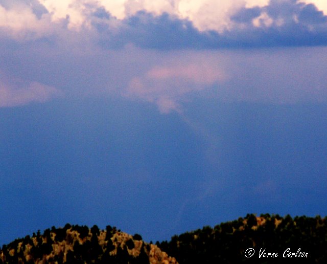

 I just watched and videoed this tornado over Bennett that was visible from all the way up at our house in Coal Creek Canyon (50 miles away - line of site). This tornado was on the ground for up to 5 minutes. Michael and Eric were out chasing today and were able to get much closer shots and video! More pics to come soon!
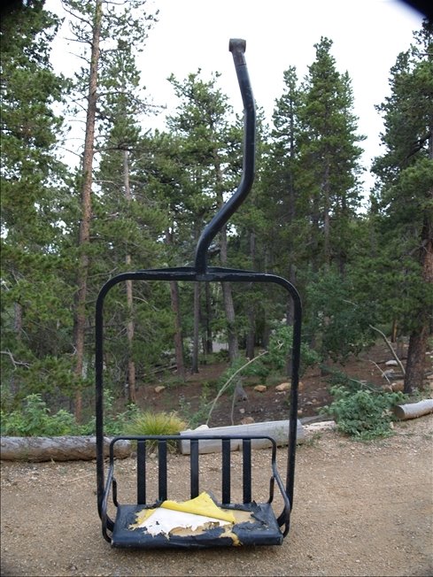
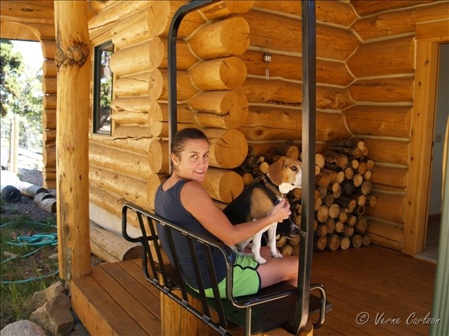
 I was surprised to find that these chairs came from the manufacturer with yellow vinyl seat covers. At some point they were stapled over with black vinyl. I will be replacing the pad and cover with the black operational vinyl.
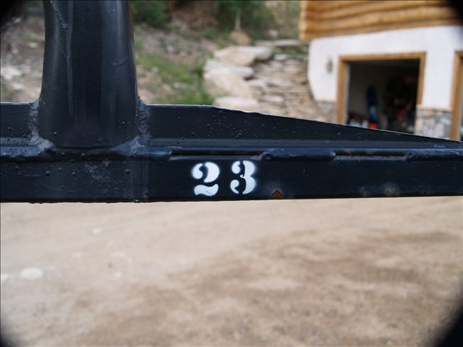 Getting a true piece of history, I was lucky enough to buy old ski lift chair #23 that spent many decades shuttling skiers and snowboarders on the Lenawee lift at Arapahoe Basin, Colorado! In 2001 the old two person Lenawee lift was taken down in favor of a new higher speed three chair. Over the next few days and weeks I will be restoring her to her former glory with a new coat of paint, new knee board, and all new padding and vinyl cover. When all done, this chair will become our new front porch seat.

 Tonight I was lucky enough to catch a couple bolts of lightning that lit up downtown Denver. This picture was taken from the window of my livingroom.

Latest image from Verne's mobile picture phone. A nice little cell just popped up over the flatirons of Boulder at lunch. Had some nice low-level structure and lightning.


 Here is a zoom of the bolt on the right where you can see it hitting some kind of structure.