


 Edit: Day 2 is out and shows the trend towards bringing this system back west!
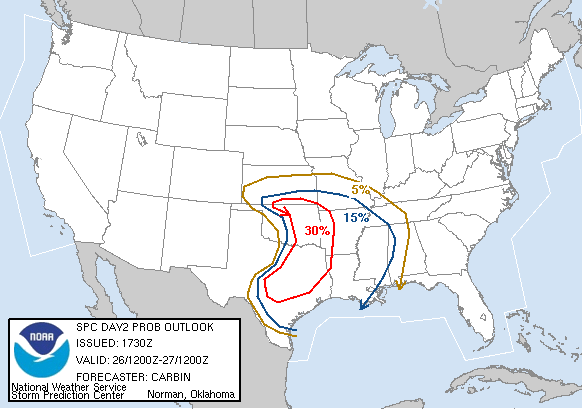
 Latest WRF has slowed the incoming system considerably making a sc KS chase a real possibility now. Major downside is that on the cold side of this system is a potential blizzard in e CO!
Wichita HWO:
ON THURSDAY...THUNDERSTORMS ARE FORECAST FOR ALL OF SOUTH-CENTRALAND SOUTHEAST KANSAS...AND MAY BE QUITE STRONG WITH 3/4 INCHDIAMETER HAIL AND GUSTS AROUND 50 MPH.


No comments:
Post a Comment