Live Geo-referenced Storm Chaser Video. First in the Field Aerial Live Streaming and Aerial Storm Intercepts. High Resolution Level II Radar Data. Severe Weather Forecasts and Reports by Storm Chasers/Severe Weather Videographers Verne, Michael and Eric Carlson. For live stream and video licensing contact us at: vernecarlson@hotmail.com

KRDO ColoSprgs Storm Chasers!

KRDO

KAKE Wichita Storm Chase Team!

KAKE

Denver's Channel 7 Storm Chasers

KMGH 7 News

License this Live Stream Now!

Follow us LIVE on iMap Tracker! When you see a car we are live.


Sunday, March 18, 2007

Looking ahead at next week

Sitting in Golden this morning at Big Daddys bagel shop enjoying the nice weather and thinking about the upcoming week.


Everything looks for a chase starting Tueday night into Friday with a return to Denver Saturday!

But wait! What's this out on the end of the GFS for next Tues Mar 27th? Another big system landing in western Kansas. This could be the next one after this week!

Wednesday, March 14, 2007

Weds now on the UCAR GFS site


GFS tonight shows a 1000mb surface low over sw KS, 60 Tds up to the KS/OK border and a nice digging trough over the west.
Interestingly, even Tuesday Mar 20th has this setup although with the upper trough slightly further west. Jeez, now we're looking at Tuesday thru Saturday as chase days!


Multiple days of chasing next week

The GFS model continues to show weds to fri and possibly even sat as chase days in the southern plains. The upper level 500mb winds show a digging trough into NM and TX even though it is a little dissorganized. The GFS wants to break this trough completely from the polar flow but can't seem to quite do it yet. I think as we get closer to next week the models will pull the main upper flow into this trough and overall strengthen it.

The trend at the lower levels is for more cape and higher dewpoints into the panhandles and western OK. Capes are now above 1500 J/kg and apporaching 2000 into TX.

With this I have submitted my vacation request for Wed, Thur and Fri! I would be ready to leave Tue night and be out until Sunday so I am good to go on what looks like a great back-to-back-to-back-to-back chase setup!~

Tuesday, March 13, 2007

Nice sunset

Trying out some more panorama shots from my mobile phone. Got this nice sunset tonight from my deck!

Monday, March 12, 2007

Weds Mar 21st holding in there


Been watching Weds March 21st for a few days now and there's good news and okay news. The okay news is that the 500mb negative trough that I was seeing early on is now a much weaker cut-off low. The good news is that the return flow off the gulf is awesome! Nice theta-e air advection is all the way into SD and down into the TX panhandle with capes of 1000 - 1500 J/kg. This first day of what could be a weds/thurs/fri event would possibly be in western KS!

Sunday, March 11, 2007

Panorama from my deck

Ok the panorama below was pretty bad lighting. This one is a little better. The view from my deck looking east out over Denver. Enjoying the extended daylight today and looking forward to a possible chase starting on the 21st or 22nd!

Saturday, March 10, 2007

Dumping snow at our house


It looked like the sun would peek out and we'd get a nice warm day but now snow is coming down in big paper plate sized flakes! Winter's not done with us yet.


Oh and what's this, way out on the GFS potentially hitting the plains Weds March 21st?? A nice negatively tilted trough coming into the west coast! Have to keep an eye on this one.

Panorama blogging from my cell phone!

Testing out panorama shots from my cell phone!

Thursday, March 08, 2007

Early signs of convection in Denver, CO

A weak cold front is moving across Colorado today bringing with it a little lift and some signs of convection. Things I like to see each year around this time.

Wednesday, March 07, 2007

Trying new data sources

So yesterday I looked into the SpotterNetwork after hearing good things from Al Petrycha at the NSCC in Feb and on the compatibility chart it shows StormLab as being the app with the most green checked items for compatibility.

I went ahead and ordered a copy of StormLab and Interwarn. Both products I found were distributed (and maybe written by) meteorogist Evan Bookbinder. I had sent Evan copies of the Storms of 2004, 5 & 6 late last year to be used as spotter training material.

So today in my inbox I have my new authorization codes for both products and will be installing them over lunch and seeing how they work.

I’m still on the fence about what to do with wxworx which has been a great tool and continues to be. I think this will be a transition year for my data sources as I field test cell phone provided data thru StormLab/Interwarn and XM satellite data thru Baron wxworx. I lknow that the Cingular coverage map has large holes in w NE parts of SD and some areas off the interstate in w KS. All areas I find myself in often during chase season.

Tuesday, March 06, 2007

Next chase March 16th?

Looking ahead at the GFS there appears to be the possibility of a chase in the March 16th timeframe. This would work out well since it would make it a weekend chase with a Thursday night departure and return sometime on Saturday or Sunday.

Yesterday I had a doctors appt in Boulder so I took the opportunity to try mobile internet access through my cell phone and laptop. I had previously found instructions on the web on how to setup the phone as a wireless modem. I have to say it was very cool to be able to be logged into all my email accounts, have AIM up and be able to see websites on the road. This will make it very handy to keep in touch while out storm chasing.

I have been working on a mobile webpage that has all my favorite links on it. It is formatted to be the width of my mobile phone but can also be displayed on my laptop for quick access to all my data. http://www.stormchaserco.com/mobile.html

Tuesday, February 27, 2007

Testing my new 8525 PocketPC

This is a mobile post from my new phone! The trick was to delete my old entries in blogger even though the phone# was the same.

Monday, February 26, 2007

From Mike Nelson's 7 Weather Blog

February 24, 2007 - Local Storm Chasers Bag First Tornado Of Season

Local storm chasers Verne Carlson, Michael Carlson and Tony Laubach saw their first tornado of the 2007 chase season on Friday.


In anticipation of strong developing low pressure on the central plains, they left Denver Thursday afternoon for Garden City, Kansas.

After analyzing data on Friday, they decided to target western Oklahoma and the Texas panhandle for severe thunderstorm development.

A dryline setup Friday afternoon between Amarillo and Shamrock in the Texas panhandle, so the storm chasers made their way west along Interstate 40 to the small town of McLean.

A dryline is the boundary between moist air and dry air, which serves as a focal point for thunderstorm development.

By the afternoon hours, three thunderstorm cells fired up and moved north along the dryline. The first storm was rather weak, but the second storm showed signs of rotation.

As the rotation grew stronger, a funnel cloud dropped from the base of the storm. The funnel soon took on the classic cone shape and dropped to the ground, forming a tornado.

The tornado stayed on the ground about 5 minutes near the town of McLean, Texas. You can see a picture of the twister by clicking here.

Now Tony, Verne and Michael are driving through 60 mph wind gusts from the departing storm as they make their way home to Colorado.

Saturday, February 24, 2007

Feb 23, 2007 McLean, TX Tornado Chase


Here's our crew for the case ((c) Jketcham) Tony, Myself and Michael after our successful tornado intercept!

Tornado at it's most pronounced. We are viewing it through the powerpoles over McLean, TX as the tornado moves north of town.


Rotation moves over I-40 as a funnel aloft.


Intercepted the tornado that came south of I-40 and moved over McLean, TX then touched down briefly north of town before dissipating. Chasing with Michael and Tony Laubach. We started the morning in Garden City, KS - drove south and west through western OK while checking data all the way. Tony's tethered mobile phone proved to be priceless as we were able to see the SPC mesoanalysis pages and target eastern TX panhandle.


First Tornado in Feb and first in Texas! 2007 is off to a great start!

Michael and I made it onto the 5:00pm and 10:00pm News 7 abc broadcast.


The SPC storm archive page for this date is available here:


Mileage: 1150
Motel Stays: 1

Friday, February 23, 2007

Multimedia message

Tornado spotted by our group! Mclean, TX

Multimedia message

Latest image from Verne's mobile picture phone. Severe warned w of shamrock!

Multimedia message

Latest image from Verne's mobile picture phone. Shamrock, TX

Thursday, February 22, 2007

Day 1 SPC is out this evening, 15% torn 60% hail unreal!


...THERE IS A MDT RISK OF SVR TSTMS FROM CENTRAL KS...SWD INTO NWRN TX... ...THERE IS A SLGT RISK OF SVR TSTMS SURROUNDING THE MDT RISK FROM CENTRAL TX INTO SRN NEB... ...SIGNIFICANT SEVERE WEATHER EPISODE IS POSSIBLE ACROSS MUCH OF THE CENTRAL AND SOUTHERN PLAINS LATE FRIDAY INTO SATURDAY MORNING... A POWERFUL UPPER TROUGH IS MOVING ACROSS CA EARLY THIS MORNING. THIS FEATURE WILL SHIFT EAST ACROSS THE CNTRL/SRN ROCKIES LATE TODAY...INDUCING LEE CYCLOGENESIS OVER ERN CO/NWRN KS BY EARLY EVENING. PARAMETERS APPEAR TO BE COMING TOGETHER FOR WIDESPREAD...POTENTIALLY SIGNIFICANT SEVERE THUNDERSTORMS ACROSS MUCH OF KS...OK...INTO NORTH CENTRAL TX AHEAD OF ADVANCING COLD FRONT. DAMAGING WINDS...VERY LARGE HAIL...AND TORNADOES ARE POSSIBLE. INTENSE MID LEVEL HEIGHT FALLS WILL SPREAD/DEVELOP INTO THE HIGH PLAINS DURING THE LATTER HALF OF THE PERIOD WHERE 12 HOUR FALLS IN EXCESS OF 200 M ARE POSSIBLE. ADDITIONALLY...STRENGTH OF UPPER SYSTEM IS EVIDENT BY DIGGING UPPER JET INTO WEST TX WHICH SHOULD APPROACH 110 KT BY THE END OF THE PERIOD AT 500 MB. NEEDLESS TO SAY...SHEAR PROFILES WILL BECOME VERY INTENSE ACROSS THE SOUTHERN AND CENTRAL PLAINS AS THIS UPPER SPEED MAX SPREADS ATOP STRENGTHENING LLJ FROM TX INTO ERN NEB. OF PARTICULAR CONCERN THIS PERIOD IS THE EXPECTED BOUNDARY LAYER MOISTURE RETURN ACROSS TX...NWD INTO THE STRONGLY FORCED REGION OVER OK INTO KS. LATE EVENING MODEL GUIDANCE INSISTS MID-UPPER 50S DEW POINTS WILL SURGE NWD ALONG AN AXIS FROM THE EDWARDS PLATEAU OF SWRN TX...NWD ACROSS WRN OK...POSSIBLY INTO PORTIONS OF SOUTH CENTRAL KS. GIVEN THE VERY COLD MID LEVEL TEMPERATURES THAT WILL SPREAD ACROSS THIS REGION...APPROACHING MINUS 20 AT 500MB...MORE THAN ADEQUATE INSTABILITY SHOULD EVOLVE ALONG/EAST OF DRY LINE BY 00Z. AT THIS TIME IT APPEARS VERY STEEP LOW-MID LEVEL LAPSE RATES WILL EVOLVE ACROSS THE HIGH PLAINS OF TX DUE TO STRONG DIURNAL HEATING. SURFACE TEMPERATURES SHOULD WARM INTO THE MID 70S ACROSS NWRN TX WITH DEW POINTS EXPECTED TO HOLD IN THE MID 50S ALONG THE DRY LINE. FORECAST SOUNDINGS SUGGEST MLCAPE VALUES COULD EASILY EXCEED 1500 J/KG FROM WEST OF ABI...NWD ALONG THE TX/OK BORDER. IT APPEARS PARCELS SHOULD FREELY CONVECT...DESPITE WEAK CONVERGENCE ALONG THE DRY LINE...MAINLY DUE TO HEATING AND WEAKENED CAP. LATEST THINKING IS ISOLATED SUPERCELLS WILL EVOLVE ACROSS NWRN TX INTO SWRN KS BY 00Z...THEN MOVE QUICKLY ENEWD AT ROUGHLY 40 KT WITHIN A VERY FAVORABLE SHEARED ENVIRONMENT. FORECAST SOUNDINGS SUGGEST SHEAR WITHIN THE INFLOW LAYER WELL IN EXCESS OF 400 M2/S2. IF SUPERCELLS EVOLVE AS EXPECTED...TORNADOES ARE POSSIBLE. WITH TIME THIS ACTIVITY WILL EVOLVE INTO A SQUALL LINE...POTENTIALLY INTENSE...AS VERY STRONG FORCING SPREADS ACROSS THIS ONGOING CONVECTION. ADDITIONALLY...VERY LARGE HAIL SHOULD ACCOMPANY SUPERCELLS WITHIN INSTABILITY AXIS. A WELL ORGANIZED LINEAR MCS...WITH EMBEDDED SUPERCELLS...SHOULD SPREAD ACROSS MOST OF CENTRAL KS/OK INTO NCNTRL TX BY THE END OF THE PERIOD.

Multimedia message

Latest image from Verne's mobile picture phone. Heading out to Garden City, KS

Friday Feb 23rd now upgraded to Moderate!


Wednesday, February 21, 2007

Friday is now on the Day 3 radar - looking good!


...GREAT PLAINS... AN IMPRESSIVE UPPER-LEVEL TROUGH WILL MOVE EWD ACROSS THE WRN U.S. FRIDAY CLOSING OFF OVER THE SCNTRL ROCKIES FRIDAY NIGHT. AHEAD OF THE UPPER-LEVEL SYSTEM...A VERY STRONG 70 KT LOW-LEVEL JET WILL DEVELOP IN THE SRN PLAINS AND A MOIST AXIS WILL SET UP FROM NW TX EXTENDING NWD ACROSS WRN OK INTO WCNTRL KS FRIDAY AFTERNOON. SFC DEWPOINTS BY LATE FRIDAY AFTERNOON SHOULD REACH THE 55 TO 58 F RANGE ALLOWING FOR POCKETS OF MODERATE INSTABILITY JUST EAST OF A WELL-DEFINED DRYLINE. ALTHOUGH PARTS OF THE MOIST AXIS MAY REMAIN CAPPED FRIDAY AFTERNOON...SOME THUNDERSTORM ACTIVITY SHOULD INITIATE BY LATE AFTERNOON OR EARLY EVENING ON FRIDAY ACROSS WRN OK AND THE LOW-ROLLING PLAINS OF NORTHWEST TX. ONCE CONVECTION INITIATES...SUPERCELL DEVELOPMENT SHOULD QUICKLY OCCUR DUE TO STRONG VERTICAL SHEAR OF 60-70 KT. IN ADDITION...STORM DEVELOPMENT WILL BE AIDED BY VERY STRONG DYNAMICS ASSOCIATED WITH THE EXIT REGION OF AN EJECTING 100 KT MID-LEVEL JET. FORECAST SOUNDINGS ACROSS NW TX AND WRN OK LATE FRIDAY AFTERNOON SHOW CLASSIC LOADED-GUN TYPE SOUNDINGS WITH 0-3 KM SRH INCREASING TO ABOVE 500 M2/S2 DURING THE EVENING. THIS SUGGESTS SUPERCELLS WILL BE CAPABLE OF PRODUCING TORNADOES. THIS COMBINED WITH 0-1 KM SHEAR VALUES EXCEEDING 30 KT WILL MAKE STRONG TORNADOES A POSSIBILITY FRIDAY EVENING...SHOULD STRONG CAPPING BE OVERCOME. VERY LARGE HAIL AND WIND DAMAGE WILL ALSO BE POSSIBLE WITH SUPERCELLS THAT DEVELOP. A BROKEN LINE OF SUPERCELLS AND/OR BOW ECHOES SHOULD MOVE EWD ACROSS WCNTRL KS...CNTRL OK AND NRN TX DURING THE OVERNIGHT PERIOD. SQUALL-LINE DEVELOPMENT APPEARS LIKELY AND SEVERE STORMS COULD OCCUR AS FAR EAST AS ERN OK/ECNTRL KS/NERN TX LATE IN THE PERIOD. ALSO...A FEW SEVERE STORMS COULD OCCUR IN CNTRL NEB BUT THIS WILL DEPEND ON THE AMOUNT OF MOISTURE RETURN THAT TAKES PLACE IN THE CNTRL PLAINS FRIDAY. IF MOISTURE RETURN ENDS UP BEING STRONGER THAN FORECAST...AN UPGRADE MAY BECOME NECESSARY IN LATER OUTLOOKS.

Tuesday, February 20, 2007

Sat Feb 24 the first chase day of the 2007 season?


Saturday looks to be the best day of the coming system. Nice compact surface low in c KS and almost vertically stacked with the upper low. Would like to see the upper low slow a bit and stay back from the surface low.
Wichita AFD is calling for low-topped supercells in central and south-central KS. Current target for Saturday: Hutchinson, KS

Friday Feb 23 the 'Day before the Day'

Friday Feb 23 looks to be an outside chance of being the first severe weather day in the plains for 2007. The surface low is in a good position and is nice and deep. The upper level jet is a little far away at 0z at the current time. For Friday to be a good chase and not a nighttime event the system will have to speed up a bit. Current target for Friday: Pratt, KS

Wednesday, February 14, 2007

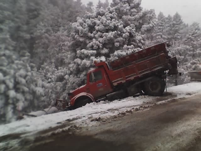
So icy on hw72 the plow even slid off the road!

Latest image from Verne's mobile picture phone. Good thing I left for home early today, this was what was greeting me at the mouth of Coal Creek Canyon. I have to say the plow operators have done a great job clearing our canyon this crazy, snowy year!

Monday, February 12, 2007

Multimedia message

Latest image from Verne's mobile picture phone. This is a test of the new blogger system.

Friday, February 09, 2007

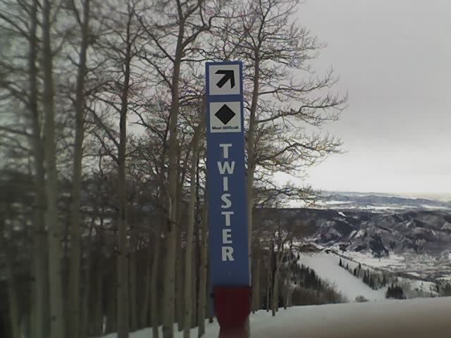
Some storm related runs at Steamboat, CO!

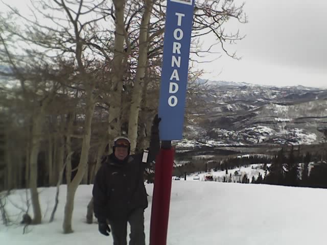
Latest image from Verne's mobile picture phone. This is the Storm Peak area at the Steamboat Ski Resort. Included are the Twister, Tornado, Cyclone, Vortex, and Hurricane. I have to say that the Tornado run was the best!

Tornado Lane!

Latest image from Verne's mobile picture phone.

The Tornado Run!

Latest image from Verne's mobile picture phone.

Wednesday, January 31, 2007

New Anemometer Toy for Chasing!


4 in 1 Digital Anemometer, Thermometer, Hygrometer & Light Meter (DLAF8000) with LanyardDLAF8000
4 in 1 professional measuring instrument: Anemometer, Hygrometer, Thermometer, and Light meter
Compact bone shape with lightweight and small size case design are suitable
Wristlet design provides extra protection to the instrument especially for user one hand operation
Low-friction ball bearing mounted wheel design provides high accuracy at high and low air velocity
Exclusive photo diode and color correction filter light sensor, spectrum meets C.I.E. photopic
High precision thin-film capacitance humidity sensor with fast response to the humidity changes
Standard type K (NiCr-NiAl) thermocouple input jack suitable for all kinds of type K probe
Built- in microprocessor circuit assures excellent performance and accuracy
Concise and compact buttons arrangement, easy operation
Memorize the maximum and minimum value with recall
6 button touch pad
°C / °F selectable
Lux/Feet-candle selectable
Air velocity measuring units selectable
Multi channel display for relative humidity and temperature
Specifications:
Display: 8mm LCD display
Anemometer, Humidity, Temperature, Light Air flow range:80 to 5910 ft/min. 0.4 to 30.0 m/s 0.9 to 67.0 mph 1.4 to 108.0 km/hr 0.8 to 58.3 knots Air flow resolution: 1 ft/min, 0.1 m/s, 0.1 mph Air flow accuracy: ≤ 20 m/s 3%, >20 m/s 4% Humidity range: 10 to 95% RH, resolution 0.1% RH Humidity accuracy: 4% RH Operating humidity: 80% Max Internal Temperature range: 0 to 50° C (32 to 122° F) Temperature resolution: 0 .1 °C/°F Internal Temp. Accuracy: ± 1.2°C (±2.5°F) Operating temperature: 0 to 50 C (32 to 122 F) K type range -100 to 1300°C (-148 to 2372°F) K type accuracy ± 1% + 1 °C (± 1% + 1.8°F) Light Measurement Ranges:0 to 2200 Lux 1800 to 20,000 Lux 0 to 204.0 Fc 170 to 2000 Fc Light resolution: 1 Lux, 10 Lux, 0.1 Ft-cd, 1 Ft-cd Light Accuracy: 5% rdg ± 8dgt. Weight: 160 g (battery included) Dimensions: 156 x 60 x 33 mm (6.14 x 2.36 x 1.29 inches) Power: 9v Alkaline battery (not included)

Sunday, January 28, 2007

Eldora Ski Area - Corona Bowl

Latest image from Verne's mobile picture phone. Had to get a shot of our favorite back bowl at Eldora Ski Area. The steep and deep powder in the trees in this area make it one of the most fun snowboarding areas in Colorado!

Friday, January 26, 2007

More wind damage from Jan 8th - 115mph wind event

Latest image from Verne's mobile picture phone. This morning I stopped and snapped a shot of this highway sign along HW93 where earlier this month they recorded wind gusts up to 115mph. That's a catagory 3 hurricane! All caused by chinook winds.

Friday, January 19, 2007

Looking ahead to the early spring chase season


Taking a look this morning at a couple charts at the Climate Predicition Center and liking what I see. The charts above show easing of the drought in tornado alley as well as above normal precip for the southern plains for the next 3 months. As we all know, moisture is the life blood of thunderstorms, and the more the better!

Wednesday, January 17, 2007

Ground blizzard on HW 93 and pole snapped

Latest image from Verne's mobile picture phone. High winds are again creating snapped poles along HW93 this morning.

Tuesday, January 09, 2007

Power poles down at hw93 and 128

Latest image from Verne's mobile picture phone. This one was splintered six feet off the ground!

115mph cat 3 winds down powerlines

Latest image from Verne's mobile picture phone. This powerpole was broken clean and laid into the field

Monday, January 08, 2007

Sears Craftsman 9hp 2 Stage Snowblower

Latest image from Verne's mobile picture phone. On Sunday I called around town and found that the Sears in Lakewood had trucked in Snowblowers for sale. Since the Scout is perpetually stuck in 2 wheel drive we needed something more to get us dug out from this record breaking winter.

Amanda spoke to our neighbor up the hill who said that in 20 years of living in Coal Creek he has never seen a winter like this.

Today we had 115 mph winds (catagory 3 hurricane) that closed hw93, hw72 and US36. It took a road grader 2 trips and 1/2 hour each just to cut through two 9' drifts that had Shimley Road down to two lanes.

Saturday, January 06, 2007

Twisters restaurant in Lakewood, CO

Latest image from Verne's mobile picture phone. With Colorado locked in the grips of it's third snowstorm in as many weeks and more coming - these are the only twisters I've seen lately!

Tuesday, January 02, 2007

Multimedia message

Latest image from Verne's mobile picture phone. Need I say more?!

Multimedia message

Latest image from Verne's mobile picture phone. Very appropriate for Colorado !

The Carlsons', Verne, Michael and Eric

The Carlsons', Verne, Michael and Eric

Contact Me for Helicopter Shots!

Flying Monkeys

My Blog List