

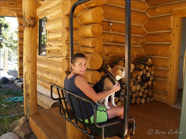
 Amanda and Mabs love 'lifty', our new lift chair porch bench!


 The storm really intensified as it neared Limon, CO. We met up with Jon M and Shawn along hw71 here.
 Storm crosses hw 71 north of Limon, CO. Golfball size hail was reported south of Limon.
 Michael and I check out the forward flank shelf cloud with many eddies in it and spinups.

 Models are showing storms firing over the Palmer Divide and heading east from 5:00pm to 10:00pm at night. Michael and I will be going out and chasing supercells. We should atleast get some good lightning shots!
 ...CNTRL HIGH PLAINS... WHILE STRONG MOISTURE RETURN DOES NOT APPEAR LIKELY ACROSS THE REGION...MODEST BOUNDARY LAYER MOISTENING WILL OCCUR NEAR LEE-TROUGH AND ADVANCING COLD FRONT FROM SWRN NEB SWD ALONG CO/KS BORDER. SURFACE DEWPOINTS AROUND 60F AND TEMPERATURES CLIMBING THROUGH THE 80S WILL CONTRIBUTE TO MODERATE DESTABILIZATION WITH LAPSE RATES STEEPENING WITH DAYTIME HEATING. MEAN LAYER CAPE ON THE ORDER OF 1500 J/KG IS ANTICIPATED BY AFTERNOON...WHEN FORCING NEAR INTERSECTION OF COLD FRONT AND SURFACE TROUGH/WEAK DRY LINE SHOULD LOCALLY ELIMINATE CAPPING ASSOCIATED WITH ELEVATED MIXED LAYER. WEAK BUT VEERING WINDS WITH HEIGHT FROM LOWER TO MID-LEVELS...BENEATH MODERATE WESTERLY HIGH LEVEL FLOW...SHOULD PROVE ADEQUATE FOR ISOLATED SUPERCELLS WITH HAIL AND HIGH WINDS. ADDITIONAL ACTIVITY WITH SEVERE HAIL POTENTIAL MAY ALSO OCCUR IN RELATIVELY MOIST POST-FRONTAL UPSLOPE FLOW REGIME FROM NEB PNHDL TO THE CO FRONT RANGE.


Latest image from Verne's mobile picture phone tornado warning! We were thinking that our chase was done when we saw Pueblo go tornado warned and 'We're Gone!'
 Created this digital photo frame in photoshop tonight so that I can frame my favorite pictures. I titled this one "Fan of Fire"

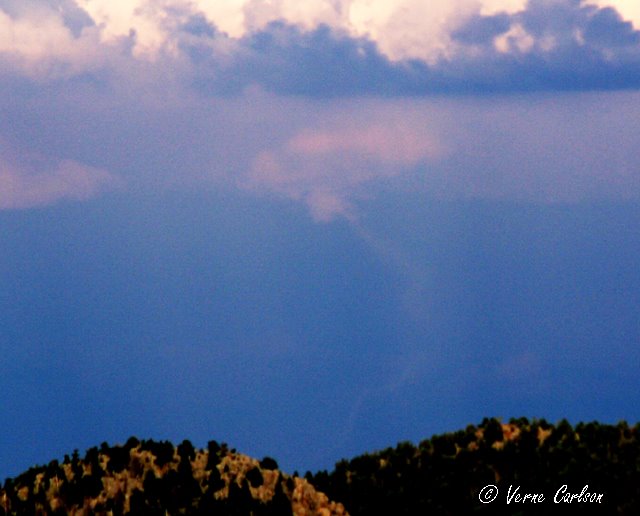

 I just watched and videoed this tornado over Bennett that was visible from all the way up at our house in Coal Creek Canyon (50 miles away - line of site). This tornado was on the ground for up to 5 minutes. Michael and Eric were out chasing today and were able to get much closer shots and video! More pics to come soon!
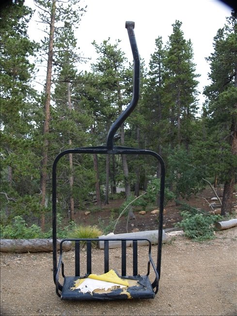
 I was surprised to find that these chairs came from the manufacturer with yellow vinyl seat covers. At some point they were stapled over with black vinyl. I will be replacing the pad and cover with the black operational vinyl.
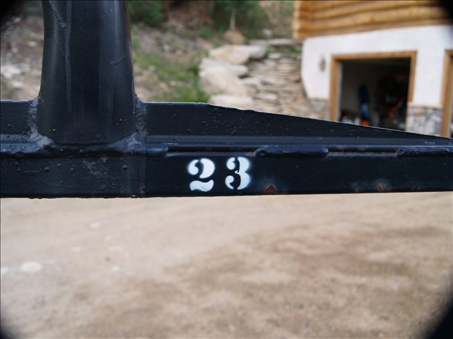 Getting a true piece of history, I was lucky enough to buy old ski lift chair #23 that spent many decades shuttling skiers and snowboarders on the Lenawee lift at Arapahoe Basin, Colorado! In 2001 the old two person Lenawee lift was taken down in favor of a new higher speed three chair. Over the next few days and weeks I will be restoring her to her former glory with a new coat of paint, new knee board, and all new padding and vinyl cover. When all done, this chair will become our new front porch seat.

 Tonight I was lucky enough to catch a couple bolts of lightning that lit up downtown Denver. This picture was taken from the window of my livingroom.

Latest image from Verne's mobile picture phone. A nice little cell just popped up over the flatirons of Boulder at lunch. Had some nice low-level structure and lightning.


 Here is a zoom of the bolt on the right where you can see it hitting some kind of structure.


 This shot was taken on maximum zoom on my 150mm lens. These are the lights of Brighton with lightning just west of Ft. Morgan in the background. Notice the little needle in the cloud bottom.


 A disturbance in WY was progged to move southeast into CO between 10pm and midnight tonight and right on queue a fast moving storm came in over the Indian Peaks wilderness and made it's way down into southern Denver. These are among the best shots I got tonight.
 This weekend Amanda and I traveled up to Spearfish, SD for her triathalon and spent the weekend exploring the Black Hills of South Dakota.On the way back I was able to go the route I used to take back from Caving at Wind Cave National Park (another whole story). It was onone of these return trips on May 11, 1991 that I saw my first significant tornado just west of Edgemont, SD on HW 18. This is a picture ofthe exact location where I first saw the beginnings of what would be the large cone tornado that Robert Phillips, Bill Hawn and myself would watch from the side of the road at this spot. I had seen funnels and tornadoes from a distance before this but this would be theone that really cemented it for me and had me hooked forever!

