Live Geo-referenced Storm Chaser Video. First in the Field Aerial Live Streaming and Aerial Storm Intercepts. High Resolution Level II Radar Data. Severe Weather Forecasts and Reports by Storm Chasers/Severe Weather Videographers Verne, Michael and Eric Carlson. For live stream and video licensing contact us at: vernecarlson@hotmail.com

KRDO ColoSprgs Storm Chasers!

KRDO

KAKE Wichita Storm Chase Team!

KAKE

Denver's Channel 7 Storm Chasers

KMGH 7 News

License this Live Stream Now!

Follow us LIVE on iMap Tracker! When you see a car we are live.


Saturday, February 28, 2009

March 7 and 8th Weekend Chase?


Saturday March 7th: A possible weekend chase in the realm of possibility according to the GFS. On saturday, western OK looks primed with up to 1500 capes, upper 50s Tds and an approaching trough.

Sunday March 8th the system takes a more neutral tilt cold core type look and makes central Kansas a player.

If I had to pull the trigger right now based on 180 hour out model runs I'd leave Friday night for AMA, chase western OK on Saturday, drive up to Russell, KS on Saturday night and be ready to chase central KS on Sunday. Getting back looks to be tricky with a possible ground blizzard in eastern CO on the backside of the system. May have to work remote on Monday and get back when highways open up again. Sunday could prove to be much like April 10, 2005 when we spent an extra night in Hays, KS waiting for I-70 to open back up!

Wednesday, February 25, 2009

Lightning in Wyoming?!


Wow who would have thought it! Amanda and I were out in the hottub when she said "I just saw lightning". Sure enough, way off to the north we watched 6 or 7 CC strikes light up the distant clouds. This has got to be the earliest we've ever seen lightning from our house in Denver! There is a surface low up north with temps in the 50s and dewpoints close to 30 - apparently enough for lightning!

SPC has a mention of it:
...WY/NORTH-CENTRAL PLAINS TO OZARKS/MIDDLE MISSISSIPPI VALLEY...
SPORADIC TSTMS WILL CONTINUE TO BE A POSSIBILITY ACROSS PORTIONS OF
WY INTO SOUTHERN SD/FAR NORTHERN NEB THIS EVENING IN CONCERT WITH
THE EASTWARD MOVEMENT OF THE AFOREMENTIONED SHORTWAVE TROUGH AND
ASSOCIATED PLUME OF STEEP MID LEVEL LAPSE RATES. LATER TONIGHT
/MAINLY AFTER 06Z/

Monday, February 23, 2009

TornadoVideos.net and Weather Decision Technologies Ink Deal

TornadoVideos.net and Weather Decision Technologies Ink Deal to Bring Storm Chaser Videos to Broadcast Markets
Streaming tornado, hurricane, severe storm and archive footage distribution for news organizations
Norman, OK, February 13, 2009--TornadoVideos.net, the premiere source of professional extreme weather photography and news for production companies, media, and weather enthusiasts, and Weather Decision Technologies, Inc. (WDT), the world's leading weather services company, are joining forces to market tornado and other extreme weather event videos to broadcasters and video production companies, worldwide.
TornadoVideos.net (TVN) deploys a close network of storm observers who drive to severe storms, hurricanes, winter or ice storms, and other visually intense weather conditions to document breaking news and live weather events on video. TVN has gained national media attention by virtue of its just-in-time and live high quality video, and the regular series of interviews it conducts after capturing severe weather event video footage. TVN has also gained notoriety due to their involvement with The Discovery Channel's series Storm Chasers.
"WDT's extensive relationships with nationwide broadcasters are a perfect fit for our extreme weather content," said Reed Timmer, Founder and Storm Chaser, TVN. "TVN members will now have a powerful distribution channel through which they can distribute their storm chase footage, as well as other live or breaking news material. WDT is simply the best in the weather business, and this is a really great combination of content and distribution," said Reed.
"WDT is excited about providing global media companies the ability to locate, view, and display on their website extreme weather videos," said Mike Eilts, President and CEO of WDT. "We look forward to working with TVN to create the most powerful resource in the United States for the distribution of extreme weather video streams and high quality footage," said Eilts.


About TornadosVideos.net TornadoVideos.net provides breaking news video, stock footage, and phone and television interviews to media networks worldwide. When natural disasters strike, TVN stormchasers are guaranteed to be at ground zero documenting all aspects of the storm. The tornado, hurricane, hail, and blizzard footage shot by the daring TVN stormchasers is unsurpassed in terms of intensity, quality, and drama. TVN has provided such services to the following news networks over the last several years: CNN, ABC, CBS, NBC, Fox News, Good Morning America, the BBC, The Weather Channel, and Univision. Interested media outlets can contact Reed Timmer via cell phone at 405-761-2807 or email at reed@tornadovideos.net.


About Weather Decision Technologies (WDT) Founded in 1999, Weather Decision Technologies has become a global leader in providing state-of-the-science weather detection, nowcasting, and forecasting systems and services to our partners and customers. WDT provides its numerical weather prediction capabilities and services for weather sensitive industries globally. WDT maintains operational and international offices in metropolitan Washington, DC; Norman, Oklahoma; Munich, Germany; and Tokyo, Japan. For more information: www.wdtinc.com.
For more information contact:Weather Decision Technologies, IncMatthew PietteTelephone: (512)736-8316Email: mpiette@wdtinc.com

Saturday, February 21, 2009

Tornado Week on The Weather Channel features the May 2008 "Windsor Tornado"

Storm Stories Returns to The Weather Channel with an Outbreak of New Episodes Beginning Feb. 22
New Season Kicks Off Tornado Week; TWC Asks Viewers to Submit Stories to be Featured in a Upcoming Storm Stories Episode
ATLANTA (February 10, 2009) - Storm Stories, the series that chronicles the true stories of survivors and rescuers battling amazing weather events, returns to The Weather Channel Feb. 22 at 8 p.m. ET. The first episode, which kicks off Tornado Week, will feature the tornado that struck Windsor, CO, in 2008. To mark the debut of the new season, The Weather Channel is giving viewers an opportunity to become part of the series by sharing their own "storm stories" online at www.weather.com/tv beginning Feb. 19th. The new Storm Stories season will consist of 26 original episodes, with the first five premiering during Tornado Week from Feb. 22-March 1.
The Feb. 22 premiere episode features the May 2008 "Windsor Tornado" that touched down in northern Colorado, destroying much in its path, threatening a campground and a news crew, and ultimately hitting a daycare center. The Weather Channel will premiere four additional new Storm Stories episodes each night during Tornado Week at 8 p.m. ET from Feb. 22-26, including:
Monday - the "Parkersburg, IA, Tornado" on May 25, 2008, killed seven people and demolished the southern half of the town; first-hand accounts are given by residents.
Tuesday - the "Greensburg, KS, Tornado" on May 4, 2007, wiped out the entire town. The story is told through the experiences of next-door neighbors who saved a mother and her baby from the rubble.
Wednesday - "Super Tuesday" tornadoes cut a swath over a wide area Feb. 5, 2008; touching stories come from people that were affected in Arkansas, Kentucky and Tennessee.
Thursday - the "Boy Scouts Tornado" hit the Little Sioux Scout Ranch in western Iowa last June, catching everyone off guard. The surviving scouts are forced to put their training to use in the midst of a terrifying situation to help keep injured scouts alive in the aftermath.

Wednesday, February 18, 2009

Long range models continue to show activity


The GFS model continues to show a nice upper level trough and warm sector return flow for the end of the month. The placement of the features may deviate a bit and if it will be saturday or sunday is up for grabs - but 60 dewpoints up into Kansas cannot be ignored. We will definately be chasing this setup as it develops. This may be our first streaming opportunity with TornadoVideos.Net and we hope to get some flights in with the heli and aircraft.
All equipment is ready to live stream from the air!
Status:
  • FM1 Heli: Up
  • FM2 Heli: Up
  • FM3 Heli: Up
  • WW5 glider: Up
  • WW3a jet: Up
  • WW3b jet: Up
  • WW3c jet: Up
  • WW3d jet: Up
  • WW3e DF jet: Down, need motor added
  • KAP: Up

Monday, February 16, 2009

Next Chase Feb 28th - Mar 01?


Okay sure it's two weeks away but the GFS did pretty good modelling the tornado outbreak on Tuesday Feb 10 in Oklahoma. A nice compact trough, 60+ dewpoints and capes into 1500 in western Kansas?? Believe it, and keep an eye on it!


Wednesday, February 11, 2009

The Carlsons are now part of the TVN chase team!

A very exciting announcement for the Carlsons' as we join forces with Reed, Joel, Chris, Heidi, Don, Dick M and all the chasers at TornadoVideos.Net!
For the first time ever we will be taking our arsenal of Helicopters, Aircraft, Gliders and Kites out storm chasing and LIVE STREAM the video from the air of storm initiation, wall clouds, tornadoes, storm damage, and hail swaths from across tornado alley!
Until now aerial footage has been limited to major metro areas where TV news helicopters are able to reach. We will be bringing our array of aerial craft to where the action is and launching the best equipment we can based on the conditions. When possible we will live stream actual tornado intercept kamikazi flights from the Wicked Witch RC Jets!
Will they make it into the vortex? Will they be torn apart in the inflow winds? You will be able to follow along on the TVN Live Chase page and find out!


Near-Storm Data and Video Gathering by RC Hobby Helicopter (The Flying Monkeys Project) - by the Carlson's
Abstract: Current technology provides for sampling by Mobile Doppler Radar Vehicles in the near-storm environment above 30m. Below 30m there is a void of sampled data down to 2m where mobile mesonet and data probe deployments pick up the sampling. These MM deployments typically sample the atmosphere from 0 - 2m AGL.

The purpose of this project is to deploy a Radio Controlled Hobby Helicopter carrying atmospheric data gathering equipment to sample the near-storm environment between 0m ground level to 30m AGL.

By making transits from the deployment location 'out into the field' at a height of 30m, a sample of the near-storm environment can be recorded in a location where access to MM vehicles is limited to existing roads.


At the same time a 1080p High Definition - gyro stabilized video camera, controlled by a cameraman (separate from the pilot) will focus on capturing the view of the tornado as it approaches and passes the location. The goal is to stay aloft over the deployment site in the inflow region of the thunderstorm as a tornado passes by.
Video, position GPS, and thermodynamic data (temperature, pressure and humidity) will be captured throughout the inflow region and RFD passage for the single site. The ideal deployment would be to capture the inflow region and also RFD passage in the same flight while holding position.


Through an agreement with TornadoVideos.Net http://www.tornadovideos.net/ - video will be streamed to thier servers in real time allowing for live viewing on the TVN website through Weather Decision Technologies http://www.wdtinc.com/


This is the first test flight and proof of concept streaming through the WDT site on March 7, 2009. Shortly after this flight I encountered three to four weak tornadoes.

Data Integrity: By using all electric powered equipment, contamination of the near atmosphere by the power system will be reduced. Temperature, humidity and pressure sensors will be mounted as far from the lipo batteries as possible (only slight warming source).
Data acquisition option 1 GPS, Temp, Baro, Humid?
Data acquisition option 2 OSD, GPS, Temp, Baro, Windspeed
Data acquisition option 3 OSD, GPS, Temp
A solution for windspeed and direction is also currently being sourced.

Aerial Storm Damage Survey by RC Hobby Aircraft
Abstract: As a low cost alternative to full scale aircraft, the idea is to loft a high resolution >5Mpixel point and shoot camera to capture storm/tornado damage. Having the system readily available and in the storm chaser's vehicle, 'first light of day' undisturbed photographs can be obtained of the damage path. Close in oblique photographs from 0 - 120m can be obtained according to current FAA rules.


Wicked Witch Project Abstract:For a never-before-seen intercept of a tornado from the air we have the Wicked Witch Jets. These are disposible low cost foam aircraft that carry wireless video cameras and can be launched into the inflow of a tornado to broadcast live streaming video of the intercept!


For heavy lifting of instrument packs and HD camcorders we have the Wicked Witch 1. This aircraft was part of the 2008 TWIST-EX project and may be repurposed for future aerial flights.


For long duration flights (up to an hour) we will use an electric powered glider. This glider can be sent up over tornado damaged areas or at the beginning of storm initiation and can stream live video to the ground as well.

For situations where the ground target is stationary for a long period of time and winds are steady we have a KAP rig (Kite Aerial Photography) that can take digital still images and stream live video of tornado damage, hail swaths and pre-storm initiation.

FAA considerations: For 2009, Aircraft will not be instrumented so as to avoid sUAS classification. Aircraft will fly as a hobbyist activity under Advisory Circular 91-57
Aircraft will operate below 120m (400ft), flight control by line-of-site, no flight within 5 miles of any airport and utilize a spotter to warn of full-scale aircraft entering the area. No overfly of populated areas will be attempted.
For 2010 and beyond it is anticipated that we will be able to expand our instruments and capabilities into the new classification proposed by the FAA and mentioned at the end of this FAA notice
"The FAA has undertaken a safety review that will examine the feasibility of creating a different category of unmanned "vehicles" that may be defined by the operator's visual line of sight and are also small and slow enough to adequately mitigate hazards to other aircraft and persons on the ground. The end product of this analysis may be a new flight authorization instrument similar to AC 91-57, but focused on operations which do not qualify as sport and recreation, but also may not require a certificate of airworthiness. They will, however, require compliance with applicable FAA regulations and guidance developed for this category."
Once this new catagory is announced, anticipated late summer 2009, we will be ready to comply and expand into this new catagory with new allowed capability.
This article also indicates a hint at this new catagory of aircraft operation...
"The act proposes the FAA be required to issue a draft notice of rule making by May 2011 to implement the approved commercial UAS integration plan.
Small UAS operating within visual line of sight may be given fast track access ahead of the full opening up of US airspace.
The draft legislation calls for the agency to "determine if certain unmanned aircraft systems may operate in the national airspace system before completion of the plan" within six months of the authorisation act being passed."
More information from the FAA:
SEC. 322. SPECIAL RULES FOR CERTAIN UNMANNED AIRCRAFT SYSTEMS.
(a) In General- Notwithstanding the requirements of sections 321 and 323, and not later than 6 months after the date of enactment of this Act, the Secretary shall determine if certain unmanned aircraft systems may operate safely in the national airspace system before completion of the plan and rulemaking required by section 321 or the guidance required by section 323.
(b) Assessment of Unmanned Aircraft Systems- In making the determination under subsection (a), the Secretary shall determine, at a minimum--
(1) which types of unmanned aircraft systems, if any, as a result of their size, weight, speed, operational capability, proximity to airports and population areas, and operation within visual line-of-sight do not create a hazard to users of the national airspace system or the public or pose a threat to national security; and
(2) whether a certificate of authorization or an airworthiness certification under section 44704 of title 49, United States Code, is required for the operation of unmanned aircraft systems identified under paragraph (1).
(c) Requirements for Safe Operation- If the Secretary determines under this section that certain unmanned aircraft systems may operate safely in the national airspace system, the Secretary shall establish requirements for the safe operation of such aircraft systems in the national airspace system.
This paper outlines the UAV activities of Vortex2 and how difficult it is to get full UAS approval in the current climate. The homepage of RECUV outlines their research into UAS including in situ sampling of mesocyclones.

Numerous tornado fatalities in Lone Grove, OK

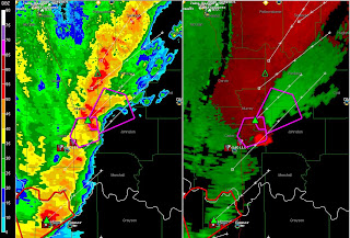
Sadly last night the town of Lone Grove, OK just northwest of Ardmore was hit by a 1/2 mile wide tornado after dark. Here is a radar grab of the storm as it left the town and you can see the bright red next to bright green couplet on the left hand velocity view showing a strong tornado.

Tuesday, February 10, 2009

Tornadoes in OKC area today!

What a surprise today was as numerous tornadoes dropped from a line of supercells WEST of OKC. The morning RUC model was the first indication to me that tornadoes would drop west of the moderate risk today making them very chaseable. Even SPC was surprised by the backing of the dryline and the slow progression and early initiation of the tornadic storms - given that they did not move the moderate risk west.

In Edmond, OK just north of OKC, 10 houses were damaged and some reports of injuries are coming in.

Channel 4 in OKC had a helicopter out capturing the tornado north of OKC. These helicopters are limited in range and we see this amazing video only from close to metro areas: OKC, Denver, Dallas, etc. This spring we will be bringing this capability to the plains - Everywhere! Stay tuned for that!

Here's the msnbc news link with the heli footage at a link on the right:
http://www.msnbc.msn.com/id/29125653/

First Tornado Outbreak of the Season Today!


A strong negative tilt trough will slam into 1500 Capes this afternoon over northeast TX and southeastern OK today. Strong tornadoes are expected through the overnight hours into the Arklatex area. SPC has even brought the tornado risk up into central KS around the surface low. This one looks potent!


THE STRONG LOW-LEVEL SHEAR AND MOIST LOW LEVELS WILL SUPPORT THE POSSIBILITY OF A FEW LONG-TRACK SUPERCELLS WITH STRONG TORNADOES LATE THIS AFTERNOON INTO EARLY TONIGHT ACROSS THE MDT RISK AREA.

Monday, February 09, 2009

Strong winds in Denver!

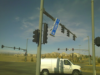
This is a street sign about to take off near Flat Iron Crossing mall. Its lierally hard to walk outside today! Verne Carlson

Sunday, February 08, 2009

Severe thunderstorm watch for the Texas Panhandle

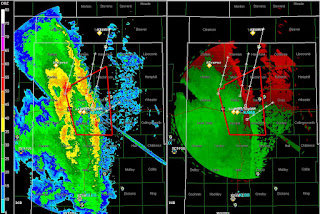
Michael's report is up now on his blog: report here where they got 1/2" hail and up to 60kts winds in eastern NM on what was the first chase day of 2009 in the plains. At this hour a severe warned squall line is hammering through the panhandle as seen on the radar grab above with some damage reported in Amarillo!

Saturday, February 07, 2009

Tornadoes in Texas Tuesday!


Michael, Tony and Dann will be chasing Sunday's setup in west Texas and while I wish them luck I am more interested now in Tuesday's possibilities. The NAM model is showing CAPES to 1000 in northcentral TX around the Wichita Falls area. A strong broad 500h trough kicks in the afternoon and the NAM radar composite shows a big beast of a storm south of the Red River. I'm keeping an eye on this one!

Wednesday, February 04, 2009

First Chase of 2009 now on the 4 - 8 day outlook

SPC now has the Sunday Feb 8th system on the 4 - 8 day outlook. While moisture return will be limiting factor on this day the shear will be impressive. Although this setup is not ideal - I am leaning towards chasing it just to get out and brush the dust of all the equipment. I really like the chase terrain on Sunday making a saturday trip to Amarillo likely and then just a short drive east into OK on Sunday. After that the system moves off to eastern OK which I have no desire to chase.

SPC text:
...ACTIVE SEVERE WEATHER PATTERN FORECAST OVER AREAS OF THE SOUTHERN/CENTRAL U.S. NEXT WEEK...

...DAY5/SUNDAY TO MONDAY MORNING... MREF AND RECENT GFS RUNS CONTINUE TO EXHIBIT GOOD RUN-TO-RUN CONSISTENCY IN THE DEVELOPMENT OF A VIGOROUS SHORT WAVE TROUGH EJECTING NEWD FROM AZ TO THE SRN/CNTRL PLAINS SUNDAY INTO MONDAY. ECMWF CONTINUES TO BE TYPICALLY SLOWER THAN THE GFS WITH THE TROUGH POSITION THROUGH 120 HOURS/SUNDAY EVENING. BUT...RECENT ECMWF RUNS HAVE BEEN TRENDING TOWARD A MORE PROGRESSIVE/EWD H5 TROUGH POSITION NOW IN CLOSE AGREEMENT WITH THE MREF H5 MEAN. THIS LENDS CONFIDENCE IN THE SYNOPTIC PATTERN BEING FORECAST ACROSS THE SRN PLAINS BY SUNDAY EVENING.

GIVEN PRONOUNCED LARGE SCALE JET COUPLING AND STRENGTHENING ASCENT DEVELOPING ACROSS TX/OK/KS THROUGH SUNDAY...DYNAMIC AND KINEMATIC ENVIRONMENT SHOULD INCREASINGLY SUPPORT THE DEVELOPMENT OF SEVERE STORMS WITH HAIL AND HIGH WINDS. AIR MASS QUALITY WILL OBVIOUSLY PLAY A ROLE IN OVERALL SEVERE STORM COVERAGE AND MODE. NUMEROUS RECENT INTRUSIONS OF COLD/DRY AIR INTO THE NW GULF SUGGEST THAT MOISTURE RETURN AND RESULTANT CAPE WITH THIS UPCOMING SYSTEM WILL LIKELY BE LIMITED. HOWEVER...THIS LIMITING FACTOR SHOULD BE SOMEWHAT OFFSET BY THE MAGNITUDE OF FORCING AND SHEAR FORECAST TO ACCOMPANY THE UPPER TROUGH...SURFACE LOW...AND FRONT MOVING OVER THE REGION THROUGH SUNDAY NIGHT/MONDAY MORNING.

The Carlsons', Verne, Michael and Eric

The Carlsons', Verne, Michael and Eric

Contact Me for Helicopter Shots!

Flying Monkeys

My Blog List

Blog Archive