Supercell thunderstorm forms from blue sky to anvil in less than an hour. McCook county goes severe warned before the first tops or radar show on wxworx, something I have never seen before. This thing is beautiful as we rapidly approach from the east on I-90!
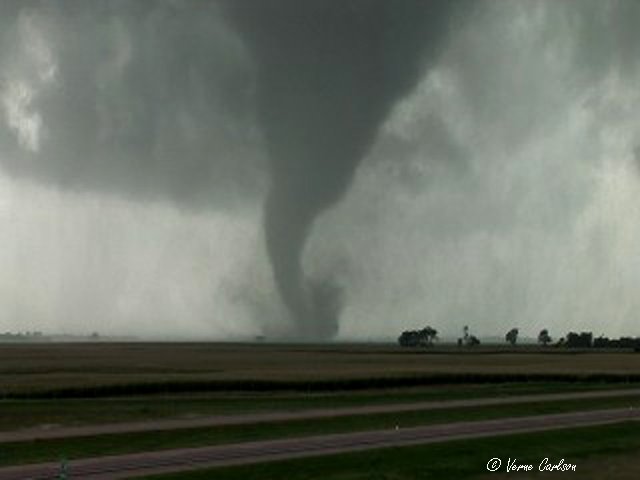
 4:10pm CDT - Touchdown! Tornado #1 forms south of I-90 just west of Sioux Falls, SD near the town of Salem. Near other known SD towns - Manchester, Spencer, and Woonsocket
 Tornado exhibits a helical motion on the ground, it's not going left, it's not going right - it's just getting larger - it's coming right at us!
 We flee east on I-90 about a mile where the tornado crosses right over the overpass where we just were! Timing Michael's video showed that the overpass was hit ~1:40 minutes after we left!
 Tornado crosses I-90, a semi-tractortrailer was tossed, no injuries.
 Tornado crosses I-90, a semi-tractortrailer was tossed, no injuries. You can hear the roar - sounds like a steady waterfall, not too loud but definately noticable.
 What's left of the cotton wood trees, leaves and small twigs fall all around us!
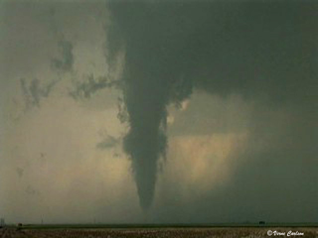
 Tornado passes in the field north of us only 50-100 yards away! That's the KELO-land TV chase car next to us. The MN chasers also come out of the circulation and drive by. Cars are turning around in the grass median as they come around the corner and see what's coming thier way! At this point the tornado is rated a borderline F3, it is scouring the ground down to the dirt!
 Tornado #1 quickly moves north away from us and losses strength. This tornado remained on the ground for 20 minutes and traveled and impressive 12 miles!
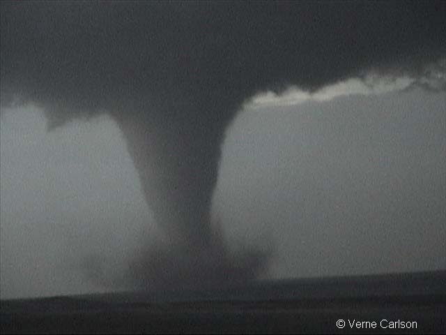
 4:30pm CDT - Tornado #1 ropes out as the meso begins to look like it will become a large wedge, had it stayed on the warm front I believe it could have been much stronger.
 A sobering site from the air as you can see where the ground has been scoured by the tornado when it was passing in the field in front of us!
 4:54pm CDT - Tornado #2 touches down northeast of Colton, SD and hits a farmstead, we later learn that thankfully no one was home.
 Debris is swirled into the air high above the cottonwood trees.
 This tornado was rated an F1 and only remained on the ground for 3 minutes.
 Score! Our best tornado intercepts ever! Many firsts today:
1) First time hearing the tornado roar!
2) First time having debris fall from the sky on us (small stuff thankfully)!
3) First time seeing damage occur (not a great thing but still a first)
 Winner, Winner - Steak Dinner! Here's our crew, Michael, Tony, Jon, Chris, Tom, and Allison
Chris Rozoff and Becca Mazur also made it up to the tornado in time to get some great shots showing structure and the tornado:
Chris Rozoff's report
Here's the official NWS report:
Sept 16, 2006 NWS Report
Here's the tornado reports for the day:
2110 4 SE SALEM MCCOOK SD 4368 9733 (FSD)
2115 5 S SALEM MCCOOK SD 4365 9739 TORNADO WITH DEBRIS SOUTH OF INTERSTATE 90 ON HIGHWAY 81 (FSD)
2118 3 W MONTROSE MCCOOK SD 4370 9724 LARGE TORNADO JUST CROSSED INTERSTATE 90 EAST OF THE CANISTOTA EXIT. (FSD)
2137 4 W CLARK CLARK SD 4488 9782 BRIEF TOUCHDOWN (ABR) 2150 4 N CLARK CLARK SD 4494 9773 BRIEF TOUCHDOWN (ABR)
2153 1 N COLTON MINNEHAHA SD 4380 9693 (FSD)
2157 2 S CHESTER LAKE SD 4387 9693 (FSD)
2205 1 E BROOKINGS BROOKINGS SD 4431 9677 (FSD)
2212 2 NNE KIMBALL BRULE SD 4377 9894 (FSD)
2310 15 S CAVOUR SANBORN SD 4416 9804 (FSD) 0208 4 NE GRETNA SARPY NE 4118 9619 180TH AND HARRISON (OAX)

Yes that's my car on the side of the road in front of the Tornado! Thanks to Brian Stertz for the use of his photo.