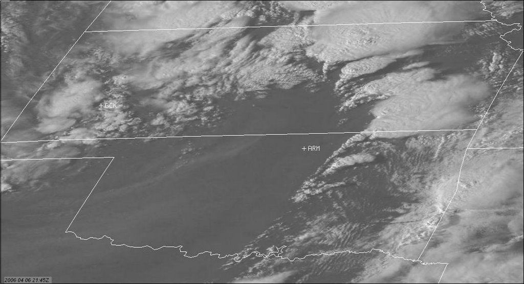
Two hours later at 21:45z storm that will create the Hanover, KS tornado is the dominant cell to the north with overshooting tops clearly visible.
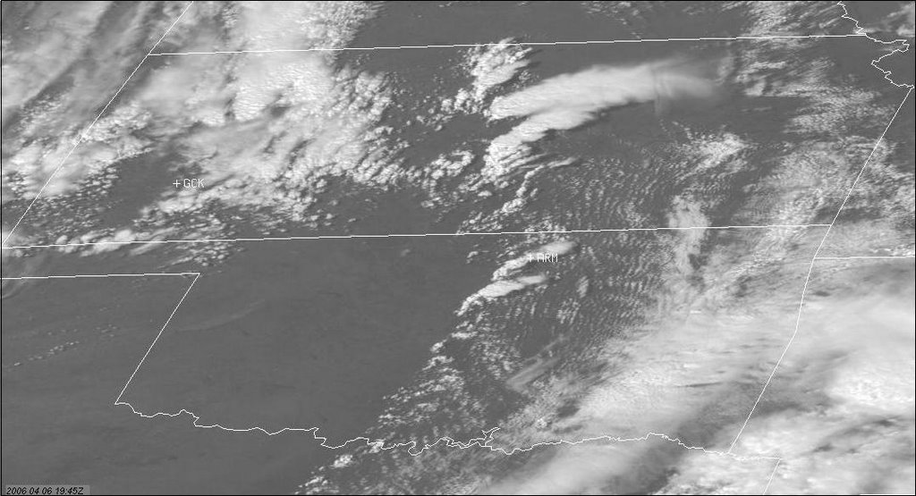
By 19:45z the dryline is clearly evident and the cell that will be the big producer is gaining strength near Salina, KS
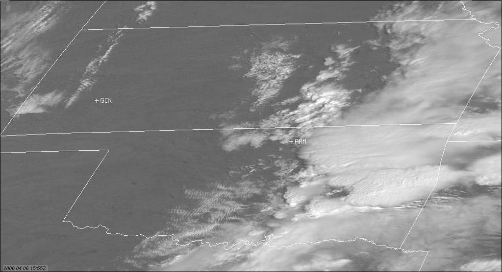
It's fun to go back and look at the progression of a big tornado day using the visible satellite images. Here at 15:55z we see the morning setup.
Doug Keisling of BNVN caught this nice elephant trunk tornado today near Hanover, KS. So far today there have been over twenty reports of tornadoes in central and northeastern KS.
Also today Tony L's 7news Storm Chaser Blog with Roger Hill and Tim Samaras went live at:
http://www.thedenverchannel.com/stormchasersblog/index.html
Tony always does the best job of describing the mood and the feel of each and every moment of the chase so it'll be great for a bigger audience to read his awesome posts!
Live Geo-referenced Storm Chaser Video. First in the Field Aerial Live Streaming and Aerial Storm Intercepts. High Resolution Level II Radar Data. Severe Weather Forecasts and Reports by Storm Chasers/Severe Weather Videographers Verne, Michael and Eric Carlson. For live stream and video licensing contact us at: vernecarlson@hotmail.com
License this Live Stream Now!
Follow us LIVE on iMap Tracker! When you see a car we are live.
Thursday, April 06, 2006
Subscribe to:
Post Comments (Atom)
The Carlsons', Verne, Michael and Eric
My Blog List
-
-
-
Frasi Di Auguri Di Fine Anno Auguri3 years ago
-
-
-
-
-
-
Odd Season8 years ago
-
Dodge City Monster9 years ago
-
Blog Has Moved10 years ago
-
-
-
Full-Up11 years ago
-
sky drama11 years ago
-
-
Hurricane Sandy11 years ago
-
A Moment in Time....11 years ago
-
-
Replacing the Free Site with Free Trials12 years ago
-
A few thoughts12 years ago
-
New York Mammatus12 years ago
-
test image13 years ago
-
-
NEW BLOG -- Update Link14 years ago
-
NEW BLOG14 years ago
-
Sams Storm Blog has moved!15 years ago
-
A World of Hurt15 years ago
-
March 28th Tornado Chase17 years ago
-
-
-
-
-
-
-
-
-
-
-
-
-
-
-
-
-
-
-
-
-
-
-
-
Links
Contributors
Blog Archive
-
▼
2006
(417)
-
▼
April
(39)
- Potential Chase Day Tuesday May 2
- Chase Log Update
- April 23, 2006 Central Kansas
- Our current location is Dodge City, KS
- Latest image from Verne's mobile picture phone. L...
- Latest image from Verne's mobile picture phone. S...
- No title
- Latest image from Verne's mobile picture phone. ...
- Heading out to our next destination. Colby, KS
- Sunday seems like it has potential
- Potential Eastern Colorado Chase Sunday
- Run for cover in Minnesota!
- Chases so far this season
- Chase potential Monday April 24th
- The Exped is a star on the Weather Channel
- Back at home after Saturday's chase
- Latest image from Verne's mobile picture phone. Tw...
- Latest image from Verne's mobile picture phone. H...
- Chase Morning at Grand Island, NE
- Latest image from Verne's mobile picture phone. We...
- Latest image from Verne's mobile picture phone.
- Heading out to our next destination. Kearny, NE
- Des Moines, IA AFD mentioning Tornadoes southwest ...
- Model analysis for Saturday April 15th
- Next potential chase day April 15
- Major Tornado Outbreak in the Midwest
- Big Tornadoes in Kansas today!
- Another potent chase setup Thurs April 6
- Days Chased so far
- Grass fire at 128th and Indiana
- Saturday April 1st Southwestern OK Chase
- Latest image from Verne's mobile picture phone. L...
- Our current location is Elk City, OK. We pull ahe...
- Latest image from Verne's mobile picture phone. R...
- Latest image from Verne's mobile picture phone. I...
- Heading out to our next destination. Pampa, TX
- Latest image from Verne's mobile picture phone. In...
- Heading out to our next destination. Gassing up ...
- No title
-
▼
April
(39)
No comments:
Post a Comment