


EDIT: Latest NAM is out, target now looks like starting at Oakley chasing to Hays. 500mb winds are a bit stronger. Cap looks breakable.
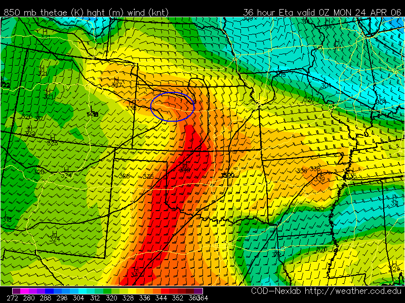
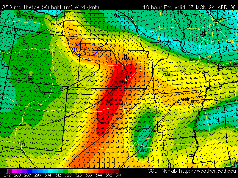
With Monday's potential way too far southeast into eastern OK (and far too weak of a setup) I am liking the idea of a Sunday out and back chase somewhere in the CO/NE/KS tri-state intersection. Yesterday's GLD AFD had mentioned Yuma, CO to Hill City, KS in a narrow band just north of there.
SPC has a higher prob out east into e KS but that is for the MCS expected to develop. Discrete cells with tornado potential may be closer to e CO/ KS
Day 2 outlook:
"WEAK MID-LEVEL IMPULSES EMANATING FROM WRN STATES TROUGH ARE EXPECTED TO MOVE EWD ACROSS THE PLAINS TOWARD THE MID MS VALLEY. LARGE SCALE ASCENT WITH THESE FEATURES AND HEIGHT FALLS ACROSS THE NRN/CENTRAL PLAINS IN ADVANCE OF CANADIAN TROUGH ARE EXPECTED TO SUPPORT THUNDERSTORM DEVELOPMENT BY MID-LATE AFTERNOON ALONG THE SURFACE BOUNDARY FROM SERN WY INTO CENTRAL KS. INCREASING WLY MID-LEVEL WINDS ATOP STRENGTHENING CENTRAL/SRN PLAINS SLY LLJ BY LATE SUNDAY AFTERNOON WILL RESULT IN STRONG DEEP LAYER SHEAR SUPPORTING SUPERCELLS CAPABLE OF PRODUCING TORNADOES"
Den AFD:
"SOME LOW LEVEL THETA E MSTR IS PROGGED TO BE OVER NORTHEASTERN COLORADO DURING THEAFTN. BEST MSTR APPEARS TO BE ALONG AND EAST OF A LINE EXTENDING FM NEW RAYMER TO AKRON. INTERACTIVE SOUNDINGS STILL SHOW GOOD DIRECTIONAL SHEAR WITH CAPES OVER 2000 J/KG. STILL A FAIR AMOUNT OFCIN AS WELL...BUT IT CERTAINLY BEARS WATCHING."
North Platte AFD:
"NAM/GFS IN GOOD AGREEMENT WITH POSITION OF SFC LOW TRACK ACROSS KS ON SUN. THIS KEEPS THE WARM FRONT TO THE SOUTH OF THE CWA ALONG WITH CHANCES FOR SEVERE WEATHER. THIS POSTION THOUGH WILL BE WATCHED AS A NORTHERLY TREND WOULD BRING THE SEVERE THREAT INTO THE SOUTHERN HALF OF THE CWA."


No comments:
Post a Comment