


 Saturday April 15th 18z
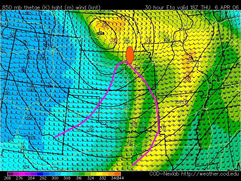 Thursday April 6th 18z
Doing a little model analysis to try and determine a target area for Saturday. Above I have compared the tornadic setup of April 6th (lower image) to the same 18z model output for upcoming April 15th. Looking at April 6th I see that the area of tornadic supercells was southeast of the surface low at the nose of the 500mb jetstreak. Applying the same analysis to the upcoming setup gives us a target area of eastern NE. The days are remarkably similar for the parameters that I've looked at with some notable differences. The most notable is the area of the 500mb jet streak and the less focused Theta-E air near the dryline. Time will tell if this sort of geometric analysis will play out.


1 comment:
Dude that's awesome!!! Oh man if I can get out east enough I'll meet ya'll there for some tornado time!!! Oh yeah for April!! Hey what do you think of Charleston WV??? There's another possible place for me to bid...wow.
:)
Post a Comment