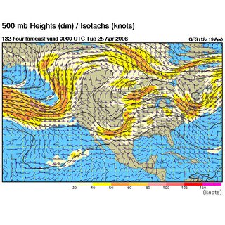
 It's still five days out but the GFS is showing a potential setup for severe weather on Monday April 24th. Looks like the area this time would be down in the panhandles of OK and TX into west and central OK.
Yesterday Chris Rozoff was discussing how the development and breakdown of the Omega blocking pattern is similar in setup to events leading up to May 3rd 1999. Gotta keep an eye on this one as this could be the system that breaks through into that high Theta-E air.


1 comment:
Oiy! It looks like I put too much faith in the long-term progs. The pattern change is remarkable just compared to two days ago. The resemblence to the pre-May 3rd event is gone away, for the most part, and we look like we are potentially headed for a NW flow regime for a little while, at least into early May, after some potential severe on Sun-Mon timeframe.
Post a Comment