Live Geo-referenced Storm Chaser Video. First in the Field Aerial Live Streaming and Aerial Storm Intercepts. High Resolution Level II Radar Data. Severe Weather Forecasts and Reports by Storm Chasers/Severe Weather Videographers Verne, Michael and Eric Carlson. For live stream and video licensing contact us at: vernecarlson@hotmail.com

KRDO ColoSprgs Storm Chasers!

KRDO

KAKE Wichita Storm Chase Team!

KAKE

Denver's Channel 7 Storm Chasers

KMGH 7 News

License this Live Stream Now!

Follow us LIVE on iMap Tracker! When you see a car we are live.


Wednesday, May 31, 2006

Eastern Colorado Meso action!

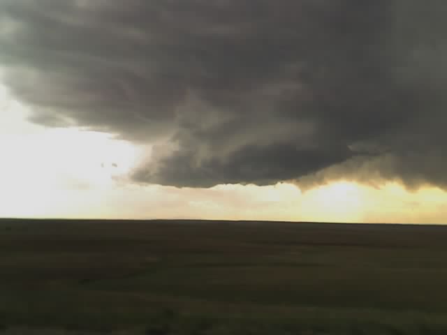
Latest image from Verne's mobile picture phone.

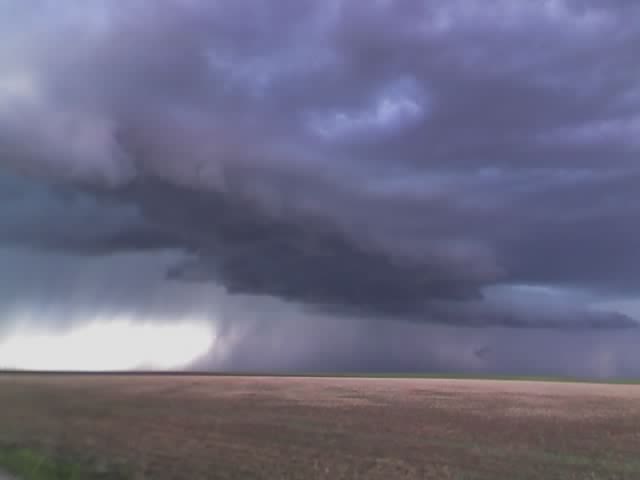
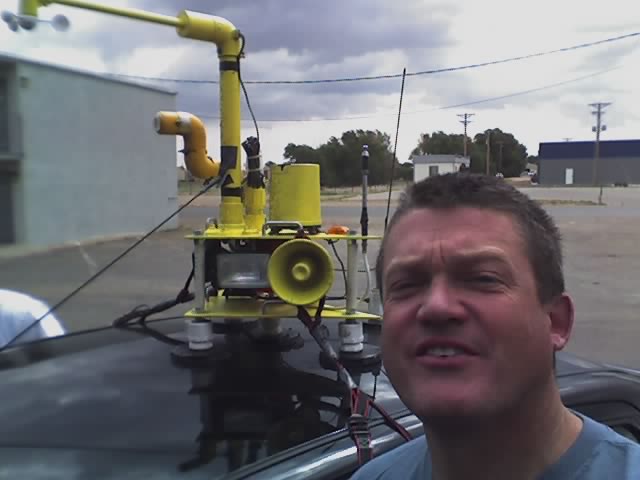
Yesterday was a fun chase day as Michael and I positioned ourselves up on the top of Cedar Point where there is a little known lookout by all the radio towers where you can see for miles in all directions. We watched as the supercell coming out of Denver started gaining structure over Agate and moving our way. It had it's best shot at dropping a tornado in this shot as it moved up the hill in front of us. It was a fun chase with the DOW truck, the TIV remnant (now a truck with a camera platform on the back) and many other chasers out for this event. Today looks like a se CO day with a potential close in chase for LP supercells out past the Colo Spgs area. Will have some pics up this morning from the last few days.

Mileage for the last 4 days: 3020 miles

Multimedia message

Latest image from Verne's mobile picture phone cedar point !

Multimedia message

Heading out to our next destination. Eastern CO !

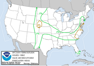
Tomorrow has a 5% tornado risk for e CO!

We are bedded down for the night in Salina, KS after a long and exciting day of chasing a meso that nearly got organized enough to drop a tornado. Dropped off Tony in Topeka to get his van and hopefully he can get back on the road. So it looks like tomorrow is our last shot for a few days and then I'll be back home with my cutie wednesday night!

Multimedia message

Heading out to our next destination. Salina, KS

Tuesday, May 30, 2006

Supercell near Elk City, OK

Latest image from Verne's mobile picture phone.

This cell moved slowly south over the afternoon, dropped reported softball sized hail, rotating wall clouds and finally cored us at an abandoned gas station along I-40 in western OK

Multimedia message

Arnett OK

Multimedia message

South of laverne OK

Multimedia message

Latest image from Verne's mobile picture phone

Watching early convection in Liberal, KS

Latest image from Verne's mobile picture phone. We are currently at the Budget Host hotel in Liberal, KS waiting for initiation. We followed this interesting cell northeast of here and came back when it lost it's structure.

Today we have a 5% chance of tornadoes and mention of isolated tornadoes and hail up to 2" in diameter. This morning I noticed that the subaru had some small hail dents.
Multimedia message

Latest image from Verne's mobile picture phone

Multimedia message

Latest image from Verne's mobile picture phone

Monday, May 29, 2006

Multimedia message

Latest image from Verne's mobile picture phone

Multimedia message

Latest image from Verne's mobile picture phone

Multimedia message

Heading out to our next destination. Liberal KS

Multimedia message

Heading out to our next destination. Topeka KS

Sunday, May 28, 2006

Multimedia message

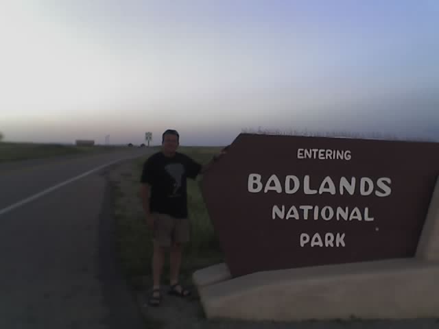
Our current location is badlands SD

Multimedia message

Checking data at a wi-fi hotspot. Murdow, SD

Multimedia message

Heading out to our next destination. Valentine, NE will adjust from there

Chasing today in South Dakota!

Cars packed, out the door! Expect SPC to move threat northeast, target Mitchell, SD - surface low is on the move.

Saturday, May 27, 2006

Friday, May 26, 2006

Multimedia message

Go take a look at my blog, stormchaserco/blogspot.com

Multimedia message

Latest image from Verne's mobile picture phone. Funnel spotted west of Limon, CO today!

Multimedia message

Latest image from Verne's mobile picture phone.

Multimedia message

Latest image from Verne's mobile picture phone.

Multimedia message

Latest image from Verne's mobile picture phone. Developing meso over Elbert, CO - Chasing?

Multimedia message

Latest image from Verne's mobile picture phone. Nicely sheared towers!

Multimedia message

Interesting storm features noted. In Deer Trail, CO

5% Tornado risk for ne CO!


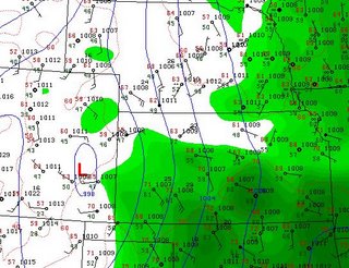
Michael alerted me this morning to the fact that SPC has ne CO/wNE in a 5% tornado risk for today. Checking surface obs I can see that there's a nicely placed surface low that means se winds are already advecting 45Tds into the Akron area with 61 Tds not that far behind in w KS. We are leaving at 11am for ne CO!

North Platte HWO: THUNDERSTORMS WILL REDEVELOP AGAIN THIS AFTERNOON AND THIS EVENING OVER WESTERN AND NORTH CENTRAL NEBRASKA AS A WARM FRONT LIFTS TO THE NORTHOVER THE AREA. THERE IS A SLIGHT RISK OF SEVERE THUNDERSTORMS MAINLY TO THE EAST OF HIGHWAY 83 OR FROM VALENTINE TO NORTH PLATTE. THE MAIN THREAT WITH THUNDERSTORMS THAT DO DEVELOP WILL BE LARGE HAIL AND POSSIBLY AN ISOLATED TORNADO.

Wednesday, May 24, 2006

Our first tornado in South Dakota!

Michael and I decided we would take the favorable I-29 south in front of the squall line and see what we could find. Just south of Bereford, SD in Union County 8:18pm CDT we drove right up on a large dusty tornado that developed right over the highway (where it tossed a 2000 gallon water tank). We pulled over and filmed it as it spun off to our east and then dissipated after 5 minutes or so and we were overtaken by the squall line. A nice little surprise non-supercellular tornado that seemed to have formed in the comma/forward bow of the squall-line. :)


Developing tornado as seen looking southeast from I-29


Tornado at it's strongest, east of the interstate


Tornado about to dissipate and we are overtaken by the squall-line and we lose it in the rain!

Tuesday, May 23, 2006

Multimedia message

Tornado spotted by our group! Union county SD 8:2O CDT

Multimedia message

Latest image from Verne's mobile picture phone.

Multimedia message

Heading out to our next destination. SD

We are headed to South Dakota


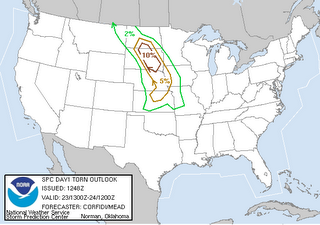
With backed surface flow and the upper low lifting north the new target for today is central SD. We are out the door in 40 minutes and heading north through the sand hills of NE. SPC has upgraded our tornado area to 10%

Monday, May 22, 2006

Pics from Monday May 22

Near Julesburg, CO interesting updraft area and shelf clouds.

Multimedia message

Latest image from Verne's mobile picture phone.

Multimedia message

Interesting storm features noted.

Multimedia message

Latest image from Verne's mobile picture phone. I-76

Multimedia message

Checking data at a wi-fi hotspot. Brush, CO

In Brush, CO

We are in Brush, CO checking wifi. Dewpoints have flushed out of CO a bit and are now in the mid 40s with southerly winds. The cirrus shield seems to be breaking to the south but the better dewpoints are to the north. Best potential seems to be to the northeast of here near the NE/KS/Co area. Now it's wait and see.

Multimedia message

Heading out to our next destination. Brush CO

Target today is eastern CO!


Waking up today in McCook, NE and surprised that SPC has less than 2% tornado risk. Denver AFD has stronger wording. Tds in Limon are 54 this morning which is the best seen all year. Can see a Denver Cyclone setting up with winds in Ft. Collins out of the north and Akron out of the south. Things look great today for some storm action!

From the Den AFD: MAIN CONCERN TODAY IS POTENTIAL SEVERE WEATHER OUTBREAK ACROSS MUCHOF NORTHEAST COLORADO THIS AFTERNOON AND EVENING. MAIN CULPRIT ISSTRONG NEG TILTED TROF NOW COMING ONSHORE ACROSS SRN CA. THE LOWWILL RAPIDLY MOVE TOWARDS THE 4 CORNERS REGION BY 00Z TUE AND THENOVER THE FRONT RANGE TOWARDS 12Z TUE. FAIRLY DECENT ASCENT NOTEDFROM QG VERTICAL VEL FIELDS BY LATER THIS AFTN AND TNT WHILE 70KTJET CORE LIFTS ACROSS NERN CO BY LATER TNT. MID LVL FLOW ALSOINCREASES TODAY WITH SPEEDS OF 35-40KT WHILE LOW LVL FLOW INCREASESFROM THE S-SE. FCST SOUNDINGS INDICATE CAPE VALUES AROUND 1500J/KGOVER THE URBAN CORRIDOR AND INCREASES TO OVER 2000J/KG FURTHER EASTWARD. ABOVE FACTORS CONDUCIVE TO SOME STORMS BECOMING SEVEREWITH SUPERCELL CHARACTERISTICS. SPC ALSO HAS ALL OF NERN CO INSLIGHT CHC OF SEVERE TODAY AND THIS LOOKS GOOD. THE STRONGEST STORMS WILL BE EAST OF THE URBAN CORRIDOR IN THE RICHER MOISTURE...WITH THE POTENTIAL FOR LARGE HAIL(UP TO 2" DIAMATER) AND DAMAGING WINDS.HOWEVER...EVEN OVER THE URBAN CORRIDOR EXPECT A FEW SEVERE STORMS ASWELL. GIVEN THE THE STRONG SERLY LOW LVL FLOW EXPECT EVEN A FEW TORNADOES AS WELL.

Sunday, May 21, 2006

Meso at sunset northwest of McCook, NE

I call this photo 'The Cobra Head'
Michael, Tony and I are currently bedding down for the night at the Holiday Inn Express in McCook, NE. Had some surprisingly good storms for such a weak setup. Tomorrow and Tuesday look to be the main show, very excited to get out and chase again!

Lightning shots from today near McCook, NE


The Carlsons', Verne, Michael and Eric

The Carlsons', Verne, Michael and Eric

Contact Me for Helicopter Shots!

Flying Monkeys

My Blog List

Blog Archive