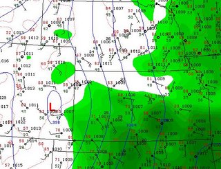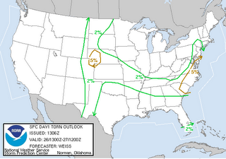
 Michael alerted me this morning to the fact that SPC has ne CO/wNE in a 5% tornado risk for today. Checking surface obs I can see that there's a nicely placed surface low that means se winds are already advecting 45Tds into the Akron area with 61 Tds not that far behind in w KS. We are leaving at 11am for ne CO!
North Platte HWO: THUNDERSTORMS WILL REDEVELOP AGAIN THIS AFTERNOON AND THIS EVENING OVER WESTERN AND NORTH CENTRAL NEBRASKA AS A WARM FRONT LIFTS TO THE NORTHOVER THE AREA. THERE IS A SLIGHT RISK OF SEVERE THUNDERSTORMS MAINLY TO THE EAST OF HIGHWAY 83 OR FROM VALENTINE TO NORTH PLATTE. THE MAIN THREAT WITH THUNDERSTORMS THAT DO DEVELOP WILL BE LARGE HAIL AND POSSIBLY AN ISOLATED TORNADO.


No comments:
Post a Comment