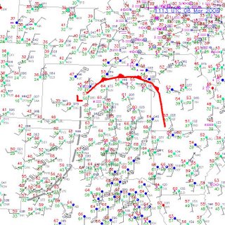

Today is our best shot at a tornado in chaseable country today. This is one of those 'synoptically evident' classic setups. We have a surface low already in western KS, north of DDC with a warm front holding across central - eastern KS and a trailing dryline down into OK. expect these features to move east during the day. The plan for the day is to meet with Tony L who has stayed overnight somewhere near Wichita, play the triple-point east of the surface front, drop south along the dryline and then return home thru Pueblo along I-25 and avoid most of the snow. Today looks like a good day and I have renewed confidence that we will see 'something' today!


2 comments:
I will be watching yours and Amos M's blogs for the latest. I hope you have luck today. I am watching from NE Iowa (djmweatherman)
Awesome - welcome aboard!
Post a Comment