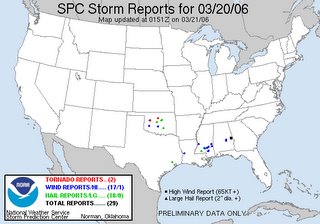
 SPC had a 10% hatched area and tornado watch box out for Louisiana today. But where did the tornadoes form today? Back by the surface low in central OK. At 21Z the surface low was in the OK panhandles with the 500mb low lagging slightly west of it. We had a dry intrusion from the southwest pushing up into a narrow instability axis. As described by Jon Davies, the 0-3Km lapse rates pointed the way to the location of low topped supercells producing a couple brief tornadoes. This underscores the need to keep these cold core setups in our minds and not chase the obvious SPC tornado targets but to look for these subtle clues and never underestimate the potential just east of a strong surface low!
March-April 2026 Storm Chasing Recap
2 days ago


No comments:
Post a Comment